
Founded by a Nepali and a Dutchie. The best of both worlds.
No mass tourism. Just honest, personal connection. Before, during and after your trip.
We pay fair wages, lighten porter loads and treat people and nature with respect.
In a nutshell
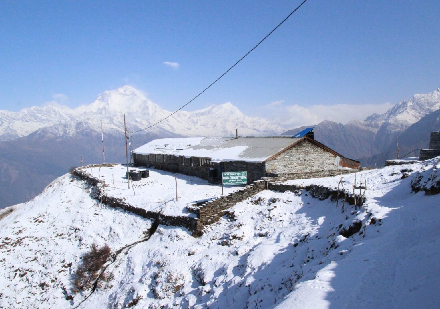
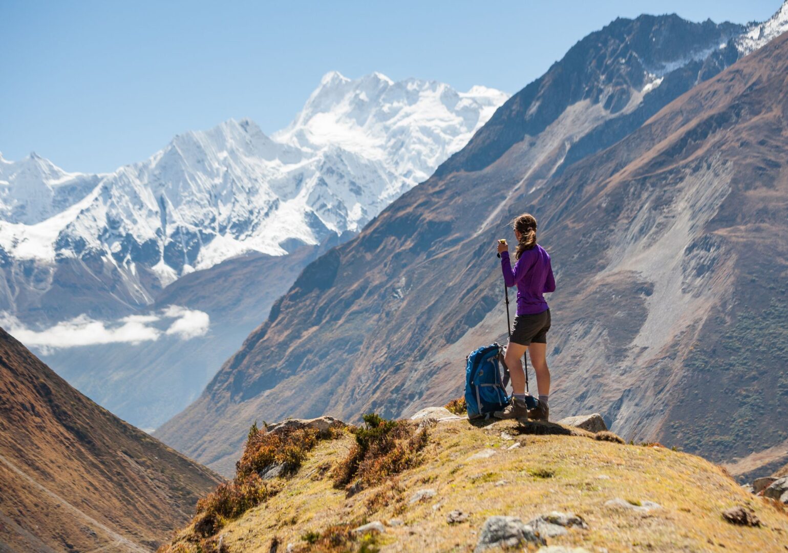
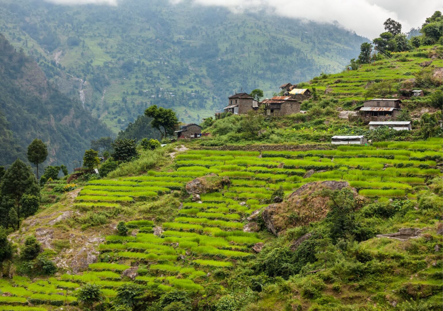
The Khopra Danda Trek takes you through the quiet part of the Annapurna region, far from the busy trails that most trekkers follow. You walk through lush forests of pine, oak, rhododendron and bamboo. And past terraced fields and traditional villages, climbing gradually to the remote Khopra ridge at 3,660 metres (12,007 ft).
From the ridge, you look down over the Kali Gandaki river, deep in the world’s deepest gorge. And up at Dhaulagiri, Annapurna I and Manaslu. Three of the 14 eight-thousanders. Three of the highest mountains in the world. Want to go higher than Khopra? There’s an optional day hike to the sacred Khayer Lake at 4,600 metres (15,090 ft). Higher than Annapurna Base Camp, and almost always deserted.
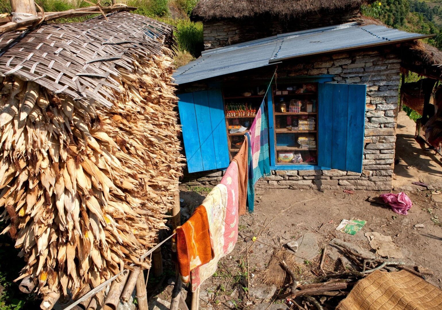
What also makes this trek special: the route passes through villages of the Magar, Gurung and other local communities that few tourists ever see. You walk literally through the daily lives of people who have lived in this area for generations.
This is a suggested itinerary. Your trip is custom-made to fit your wishes and experience. Tell us what you want. We’ll take care of the rest.


Spring (February through April) and autumn (mid-September through November) are the best seasons for this trek. The weather is stable, the skies are clear and the chance of snow at Khopra Danda is at its lowest.
Autumn is slightly busier. Spring is a little quieter, with rhododendron forests in full bloom along the route.
You don’t need to be a top athlete, but this trek does ask something of you. Think 5 to 7 hours of walking per day, several days in a row, at altitude. If you’re used to multi-day mountain hikes, you’ll generally be fine. The optional hike to Khayer Lake (4,600 m / 15,090 ft) is the most demanding section.
Not sure? Just get in touch. We’re happy to look at your experience level together and see whether this route suits you.
Altitude sickness can affect anyone. Regardless of age, fitness or experience. Even the most seasoned mountain walkers can struggle with it.
The best prevention is ascending slowly. That’s why you walk high and sleep low(er). This gives your body time to adjust to the altitude.
Drink plenty of water and listen to your body. Headaches, dizziness or nausea are signals to take seriously. Our guides are trained to recognise symptoms and will adjust the programme if necessary.
And if you do get altitude sickness? Descending is the only right choice. No debate, no hesitation. That’s not failure. That’s wisdom.
This is a suggested itinerary. A plan that shows what a trek like this can look like. Not how it has to go.
Get in touch and we’ll create a trek that fits your level of fitness and experience.
What’s included
The price of this trip is per person, based on two people travelling together and sharing a twin or double room.
Are you travelling solo or with a larger group? We are happy to make you a custom price proposal. Just send us a message and we’ll get back to you with the options.
Included in this trip
- All required trekking permits
- Licensed, English speaking trekking guide (salary, transport, accommodation, meals, gear and insurance)
- Experienced mountain porter (salary, transport, accommodation, meals, gear and insurance)
- Private transport from Pokhara to the trailhead and back
- All teahouse accommodation during your trek
- Breakfast, lunch and dinner during your trek
- 24/7 support from the By Mountain People team throughout your trip
- Booking secured through VZR Garant
- VAT and tourist service charge
Excluded
- Water, hot or cold drinks, alcohol, etc.
- Travel health insurance covering rescue and evacuation — mandatory in Nepal
- All other expenses not listed under 'Included'
Day-to-day program
This is an example itinerary. It shows you how a trek to Khopra Danda is typically structured, day by day. Because we tailor every journey to your wishes and experience, the exact program may vary.
Note: walking times are indicative and depend on your walking pace.
From Pokhara we drive to Nayapul, the starting point of the trek. We follow the bank of the Modi Khola river to Birethanti, a large village with teahouses and small shops. And then the climb begins. Steep stone steps lead up to the Magar village of Ulleri. It’s a solid start, but the first views of the Annapurna peaks more than make up for it.


Today the trail becomes quieter as we walk through ancient forests of oak and rhododendron. Via the small villages of Banthanti and Nangethanti, we continue upward to Ghorepani. It’s a varied and enjoyable day, with ever-expanding views as we gain altitude.


An early start today. With headlamps on, we set off around 5:00 AM towards Poon Hill, one of Nepal’s most famous viewpoints. From the top, we watch the sunrise over the Himalaya as the mountain peaks briefly glow golden. It’s a view that stays with you.
After breakfast, we leave the busy Poon Hill trail and take a quieter path. Via the village of Chittre, across a suspension bridge and past local grain fields, we descend to the hamlet of Swanta. This is where the real quiet begins.

Today we climb higher. It’s a longer and steeper ascent, with beautiful views of the snow-capped peaks along the way. We keep going until we reach the Khopra Danda ridge. This is not a village. It’s a small mountain hut in the wind, surrounded by a sweeping mountain panorama on all sides.


Today the choice is yours. Rest at the lodge, or hike up to the sacred Khayer Lake at 4,600 m / 15,092 ft. It’s a full day of walking with no facilities along the way, so we bring food and water.


Active rest: the ideas for today
Today is built for acclimatisation. That doesn’t mean lying still. Walking up to a higher point during the day, then back to the lodge for the night, helps your body adjust to the altitude.
Relax at the lodge
There are very few places in the world where you can sit outside with a book and have Dhaulagiri, Annapurna South and Machhapuchhre as your backdrop. No village, no noise. Just a ridge, a teahouse, and all the time in the world.
Hike to Khayer Lake
At 4,600 m / 15,092 ft, Khayer Lake sits higher than Annapurna Base Camp and is almost always deserted. The lake is sacred to Hindus and Buddhists. Once a year, during the Janai Purnima festival, pilgrims trek up here to pray and bathe in the glacial water. Next to the lake stands the Khayer Barahi temple. Keep your eyes open for rare birds on the way up.
Today we cross another mountain ridge and descend slowly into the forest towards Dobato. The name literally means “crossroads of two paths.” It’s no more than a handful of teahouses in the middle of the mountains, with views of Dhaulagiri and Annapurna South.
Want to take a small detour via Mulde Peak (3,637 m)? You can enjoy one last wide panorama over the Annapurna peaks. Get in touch for details.
Today we continue descending through the rhododendron and bamboo forests. The trail gradually levels out. It’s a pleasant day after the more demanding stages on the way up. Along the way, there’s time to look around and take in the rugged landscape.
It’s a short descent to Ghandruk, the largest village we’ve passed through since Pokhara. Ghandruk is a beautiful, authentic village with the atmosphere and culture of the Gurung community — a people you may also know from the legendary Gurkha soldiers. In the afternoon, you have time to explore the village at your own pace.


Fun fact about Gurkha soldiers
Ghandruk is one of the largest Gurung villages in Nepal. The Gurung people have a long tradition of serving as Gurkha soldiers in the British and Indian armies. Many families here have at least one member who served. The money they sent home helped build the village into what it is today.
Extra activities
Add info here; explore old village
Gurung Museum
A small community museum dedicated to Gurung culture and the Gurkha legacy. Don't expect a museum like the ones back home. It's one room, but an honest one. Traditional clothing, household tools, and weapons carried by Gurkha soldiers. A quiet way to understand the people you've been walking through.
Village walk
Narrow stone paths connect the upper and lower parts of the village, past slate-roofed houses and terraced fields. On a clear morning, Annapurna South and Machhapuchhre are right there in front of you.
Our last day of walking. Via stone steps and mountain trails, we descend to Nayapul, the point where this great trek began. Here we hop on the vehicle that takes us back ton Pokhara.


Walking & pace
We start the day early. Breakfast is at 7 AM, and we leave the lodge around 8. The morning hours are when the air is freshest and the views are at their clearest.
We stop for lunch towards the end of the morning. Lunch is freshly prepared, warm and unhurried. It can take a while for the food to come out, but that is part of the rhythm. You sit down, drink something, rest your legs and refuel for the afternoon.
In the afternoon, we usually walk a little further to reach the lodge for the night. By around five, we sit down for an early dinner. We order breakfast for the next morning at the same time, so it is ready when we are.
Throughout the day there is plenty of time to drink water, reapply sunscreen, take photos and simply look around. The mountains are not in a hurry, and neither are we.
Route

Altitude
More information
This trek takes you through the foothills of the Annapurna range. You walk an average of 4 to 5 hours per day.. We have built 1 rest day, which you can use for an optional hike.
The paths are mostly well-maintained mountain paths. Expect stone steps, rocky sections and possible snow or ice on the higher sections.
Quick facts
- Route type: loop
- Total distance: approximately 105 km
- Starting point: Nayapul, 1,070 m / 3,510 ft
- Highest point on main route: Khopra Danda, 3,660 m / 12,008 ft
- Highest point with Khayer Lake: 4,600 m / 15,092 ft
- End point: Nayapul, 1,070 m / 3,510 ft
- Number of trekking days: 9
- Highlights along the way:
- Poon Hill sunrise,
- Khopra Danda ridge
- Khayer Lake
- Ghandruk village
- Gurung culture
Practical
Everything you need to know before you go. Below you’ll find answers to the most frequently asked questions about this trip. Can’t find what you’re looking for? Feel free to reach out.
Once your trip is confirmed, you’ll receive all the practical information you need to leave well prepared. This includes visa information, recommended vaccinations and a detailed packing list.
After arriving in Kathmandu, there’s a pre-trip meeting with your guide. We go through the route, the latest weather forecasts and there’s plenty of room for any final questions. We also do a gear check — to make sure you have everything you need for the trip. Missing something, or not sure about your gear? We’ll head out together to sort it. Kathmandu has plenty of good outdoor shops. 😉
The best preparation is simply walking. Preferably several days in a row, with a backpack and elevation gain. In the months before departure, build up to walking days of 5 to 6 hours. Work on your overall fitness with cardio training (running, cycling, swimming) and don’t neglect your legs: squats, lunges and stair training work wonders.
Just as important: break in your hiking boots in time. New boots in Nepal are a guaranteed recipe for blisters. Ideally, start your training 3 to 6 months before departure.
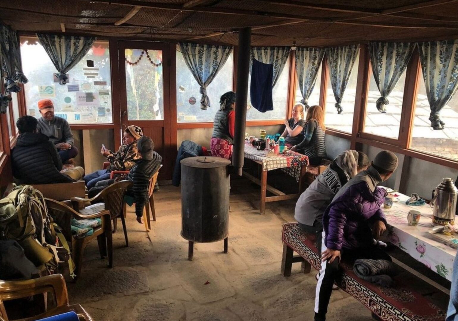
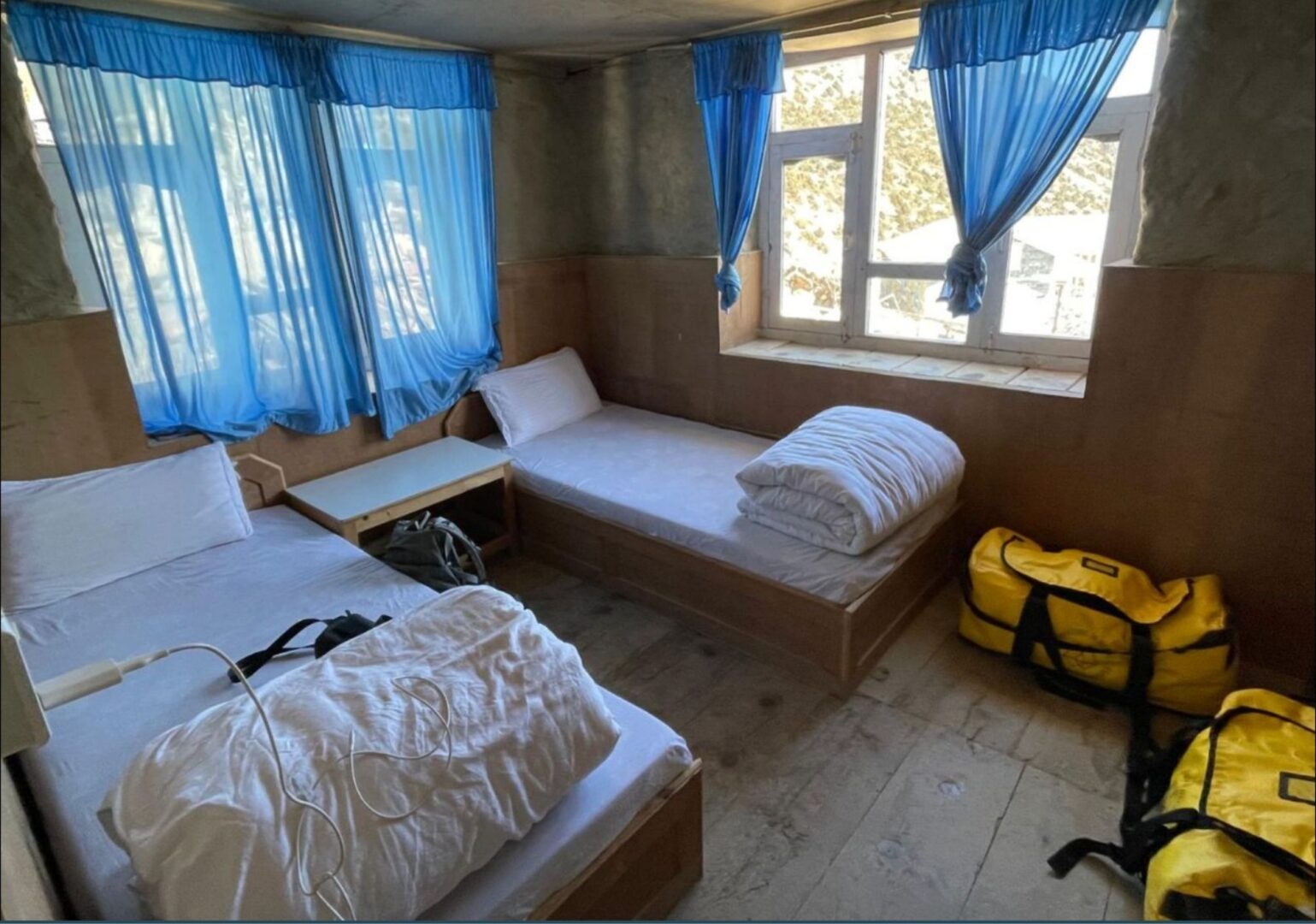
During the trek you sleep in teahouses: simple mountain lodges with firm mattresses, pillows and blankets against the cold, and dal bhat in the shared dining room.
Expect a twin room, a shared bathroom and cold water. A hot shower or wifi is sometimes possible, usually for a small extra fee. Charging your electronics is always possible, sometimes for a small fee. And then there is the warm fire in the dining room, friendly hospitality and views no hotel can match. This is the Himalaya.
PS: even though pillows and blankets are provided, we recommend bringing your own warm sleeping bag. The nights at altitude get cold, and your own bag makes a real difference. After booking, you’ll receive a detailed packing list that helps you prepare for both the trek and the nights in the lodges.
Nepal Trekking – Khopra Danda, the Quiet Annapurna Trail
- A route through a little-visited part of the Annapurna region
- Views of 3 eight-thousanders: Dhaulagiri, Annapurna I and Manaslu
- With an optional day hike to the remote Khayer Lake
Bird Watching: Annapurna Trek & Jungle Safari
Ask us a question
Bird Watching: Annapurna Trek
Ask us a questionWhat our customers have to say
Don't just take our word for it. Discover what travelers before you wrote about traveling with us.
Excited to start trekking to Nepal?
Explore sample treks in Nepal, ready for your personal touch. Customize these journeys to suit your preferences. Explore sample treks in Nepal, ready for your personal touch. Customize these journeys to suit your preferences.


Founded by a Nepali and a Dutchie. The best of both worlds.
No mass tourism. Just honest, personal connection. Before, during and after your trip.
We pay fair wages, lighten porter loads and treat people and nature with respect.
In a nutshell
The Annapurna Circuit Trek with Tilicho Lake takes you through one of Nepal’s most varied trekking regions. Over 13 days, the landscape shifts completely: from subtropical river valleys near Chamje to the vast, wind-swept highlands north of the Annapurna massif. Every day looks different from the one before.
From Chamje, you follow the Marsyangdi River upstream through forests, gorges and stone villages with Tibetan roots. The route climbs gradually. Acclimatisation days in Manang give your body time to adjust before the high section begins.
Then comes the detour that sets this trek apart. You leave the main circuit and climb to Tilicho Lake at 4,920 m / 16,138 ft. Ice-blue water, towering rock walls and a silence that stays with you. Most trekkers on the circuit never make it here.
From there, you return to the main route and face the big one: Thorong La Pass at 5,416 m / 17,769 ft, one of the highest trekking passes in the world. You start before sunrise, move slowly and steadily, and reach the summit as prayer flags snap in the wind. The descent to Muktinath is its own reward.
You end in Pokhara, with the Annapurnas reflected in Phewa Lake and a bag full of memories.
Note: This is a suggested itinerary. Your trip is custom-made to fit your wishes and experience. Tell us what your preferences. And we’ll draft a personalised day-to-day program.


Spring (February through April) and autumn (mid-September through November) are the best seasons for this trek. The weather is stable, the skies are clear and the chance of snow at Thorong La Pass is at its lowest.
Autumn is slightly busier. Spring is a little quieter, with rhododendron forests in full bloom along the route.
You don’t need to be a top athlete, but this trek does ask something of you. Think 4 to 7 hours of walking per day, several days in a row, at altitude. If you’re used to multi-day mountain hikes, you’ll generally be fine. The hike to Tilicho Lake (4,920 m / 16,141 ft) and the trek over the Thorong La Pass (5,416 m / 17,770 ft) are the most demanding sections.
Not sure? Just get in touch. We’re happy to look at your experience level together and see whether this route suits you.
This is a suggested itinerary. A plan that shows what a trek like this can look like. Not how it has to go.
Get in touch and we’ll create a trek that fits your level of fitness and experience.
Altitude sickness can affect anyone. Regardless of age, fitness or experience. Even the most seasoned mountain walkers can struggle with it.
The best prevention is ascending slowly. That’s why you never sleep more than 500 metres higher than the night before. This gives your body time to adjust to the altitude.
Drink plenty of water and listen to your body. Headaches, dizziness or nausea are signals to take seriously. Our guides are trained to recognise symptoms and will adjust the programme if necessary.
And if you do get altitude sickness? Descending is the only right choice. No debate, no hesitation. That’s not failure. That’s wisdom.
Fun fact!
Here comes a fun fact about the Annapurna Circuit Trek, Tilicho Lake or the route.
What’s included
The price of this trip is per person, based on two people travelling together and sharing a twin or double room.
Are you travelling solo or with a larger group? We are happy to make you a custom price proposal. Just send us a message and we’ll get back to you with the options.
Included in this trip
- All required trekking permits
- Licensed English speaking trekking guide (salary, transport, accommodation, meals, gear and insurance)
- Experienced mountain porter (salary, transport, accommodation, meals, gear and insurance)
- Private transport from Kathmandu to the trailhead
- Private transport from the trek endpoint to Pokhara
- All teahouse accommodation during your trek
- Breakfast, lunch and dinner during your trek
- 24/7 support from the By Mountain People team throughout your trip
- Booking secured through VZR Garant
- VAT and tourist service charge
Excluded
- Water, hot or cold drinks, alcohol, etc.
- Travel health insurance covering rescue and evacuation — mandatory in Nepal
- All other expenses not listed under 'Included'
Day-to-day program
This is an example itinerary. It shows you how the Annapurna Circuit Trek with Tilicho Lake is typically structured, day by day. Because we tailor every journey to your wishes and experience, the exact program may vary.
Note: walking times are indicative and depend on your walking pace.
In the morning, we board our jeep to Chamje (1,410 m / 4,626 ft), the starting point of our trekking. The drive takes about 7 to 8 hours. Gradually, the scenery changes: from the bustle of the city to rolling hills, rice terraces, and more rugged nature.
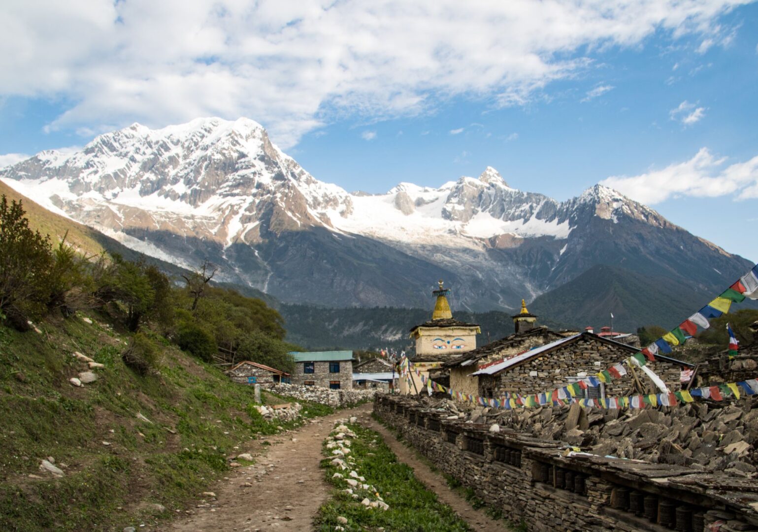
The adventure has begun! We start the trek with a steady climb along the wild Marsyangdi River. After passing through Tal and Dharapani, where the Manaslu and Annapurna routes converge, we hike onward to Bagarchhap (2,160 m / 7,087 ft). A quiet mountain village surrounded by apple trees, dal bhat, and views of snow-capped peaks.


Today, we climb through forests and along the river toward Chame (2,650 m / 8,694 ft). Along the way, we can hear the sound of yak bells, see Annapurna II suddenly loom in the distance, and meet locals with Tibetan roots. In Chame, a small hot spring awaits our tired legs.


Tip: visit the hot spring
Near the riverside of Chame, surrounded by pine trees, there are small natural hot springs. They're basic and small, and mostly quiet. If the water level is high enough, it's a nice place to visit and relax.
We start early, following a rugged path through a narrow valley filled with cliffs, forests, and rivers. Crossing suspension bridges, we ascend to Upper Pisang (3,300 m / 10,827 ft), a quiet mountain village of stone houses, a monastery, and magical mountain views.


Lower Pisang versus Upper Pisang
Most trekkers follow the lower trail and pass straight through. By climbing to Upper Pisang, you'll get a completely different experience. The two villages lie on the same mountain, but with a height difference of nearly 200 metres. Stone houses, a monastery, and views of Annapurna II. The lower village has guesthouses and a teahouse. The upper village has silence.
Extra activities
Pisang is a beautiful place to explore. From your teahouse it’s a small hike to the Monastery. Well worth the visit!

Visit the monastery
The monastery in Upper Pisang dates back around 250 years and is one of the oldest in the Annapurna region. It sits above the village on a ridge, with views that make the climb up worth every step. Inside, butter lamps flicker in front of ancient thangkas. Time moves differently up here.
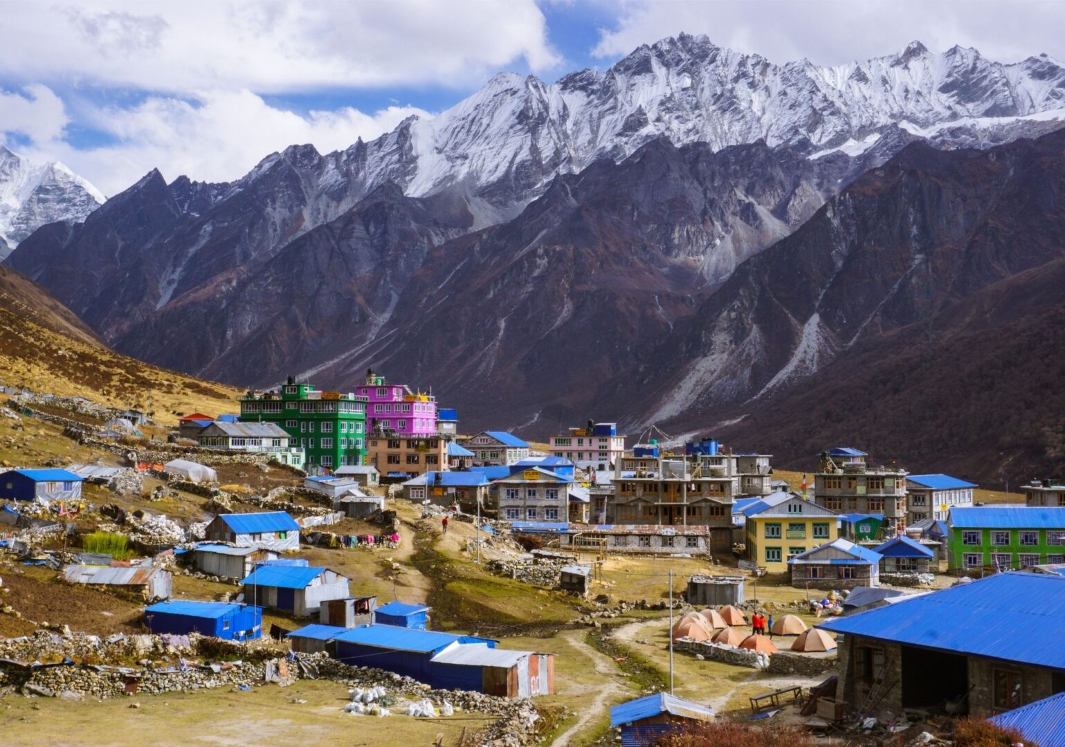
We hike through the dry, high-altitude Manang district today. This region lies in the rain shadow of the Annapurna massif, which provides clear weather and endless views. We follow one of two routes to Manang (3,540 m / 11,614 ft), situated deep within the impressive high mountains.

Extra activities
Manang is the capital of the region, so there’s a lot to explore. Want to go for a small walk? Here are some ideas.
Visit the health clinic
The Himalayan Rescue Association (HRA) runs a clinic in Manang where altitude sickness is the main topic. Every afternoon, trekkers can attend a free talk on the symptoms of AMS, what to do when things go wrong, and how to acclimatise safely. Before you head higher, this is worth an hour of your time.
Watch a movie
Manang has a cinema. A real one. Every evening, a trekking film is shown in a small room with wooden benches. It started as a way to keep trekkers entertained on their acclimatisation day. Today it is a small institution on the circuit. Bring popcorn. Or just a snicker.
Send a postcard
Manang has its own post office. At 3,540 m / 11,614 ft, it is one of the highest post offices in the world. You can send a postcard from here to anywhere on the planet. Proof that you were here, at altitude, before the big pass
We take it easy today. No major elevation gain, but plenty of time to acclimatize. If you like, we can go for a short hike. Or, just kick-back and relax in the village.


Day hike
Going for a hike today? These are 2 great options.

Hike to Gangapurna Lake
On your acclimatisation day in Manang, there is an optional hike up to Gangapurna Lake. It's located at an altitude of approximately 3,700 meters near the village of Manang.

Hike to Ice Lake
Or, choose the more challenging hike to Ice Lake at around 4,600 m / 15,092 ft. It takes about three to four hours to climb and rewards you with a glacial lake and a panorama over the entire Manang Valley.
After our rest day in Manang, we push on toward Tilicho Lake. We pass the quiet village of Khangsar and climb along rugged slopes. By the end of the day, we reach Shree Kharka: cold, silent, and pure. Time to recharge.
We trek higher into the mountains, passing a deserted monastery and crossing a steep ridge. After an exciting descent, we reach Tilicho Base Camp (4,200 m / 13,780 ft). Raw, silent, and impressive. We spend the night surrounded by mountain silence and a spectacular starry sky.


The last teahouse
Tilicho Base Camp sits at 4,150 m / 13,615 ft and serves as the overnight stop before the final climb to the lake. There are no teahouses beyond this point, and no accommodation at the lake itself. The base camp exists because the lake is too exposed and too cold to sleep near. What you find here is basic and raw: a few lodges, yak dung fires in the dining room, and a sky full of stars.
We set off early, as the wind picks up quickly here. In about 3 to 4 hours, we climb to Tilicho Lake (4,920 m / 16,141 ft). Ice-blue water surrounded by vast emptiness. Magic. Afterward, we return to Base Camp, where we soak it all in.
The holy lake
Hindus believe that Tilicho Lake is the ancient Kak Bhusundi Lake, mentioned in the epic Ramayana. The lake is considered sacred to both Hindus and Buddhists, and thousands of pilgrims travel here each year. At 4 km long and 1.2 km wide, it is still the lake with the longest diameter at this altitude in the world. Swimming is not allowed. The water is sacred and freezing.


We leave Tilicho and return to the Annapurna route. The path ascends gradually, and the landscape becomes more rugged. Less green, more stone. In the afternoon, we reach Yak Kharka (4,000 m / 13,123 ft), a quiet place amidst yaks, wind, and mountain peaks.

We continue our slow ascent. The air gets thinner, and every step feels heavier. We stop for lunch at Thorong Phedi (4,450 m / 14,600 ft) before climbing further to High Camp (4,850 m / 15,192 ft). Less sleep, perhaps, but a head start on the pass.


Today is the day: we cross the Thorong La (5,416 m / 17,770 ft). Up early, moving slowly but steadily. Every step counts. At the summit, the prayer flags flutter in the wind. We made it!
Afterward, we descend to Muktinath: warm water, more air, and a shared sense of victory.
Muktinath is one of the only sacred sites in the world revered by both Hindus and Buddhists. For Hindus, it is one of the most important temples of Lord Vishnu and the only one of the 108 Divya Desams located outside India. The outer courtyard has 108 bull-faced water spouts. Pilgrims bathe under each one, the water flows straight off the Himalayas and is shockingly cold. Buddhists know the site as Chumig Gyatsa, meaning "Hundred Waters," and believe that Guru Rinpoche meditated here on his way to Tibet.


Today, we trek down to Kagbeni and then follow the Kali Gandaki river to Jomsom (2,720 m / 8,858 ft). Jomsom is a large town with many facilities. It is also headquarter and official town for the Mustang district, where all the district government offices are present.

We rise early for the jeep ride to Pokhara. Heading toward warmer air, soft beds, and the silhouette of the Annapurnas reflected in the lake. We’ve reached the Tilicho Lake, and we’ve crossed the Thorong La pass!
Cheers to this beautiful adventure and the memories we’ve made.


Walking & pace
We’re Govinda & Valerie: a Nepali–Dutch couple with a shared love for the mountains, the people and the beautiful chaos that is Nepal. For over 10 years, we’ve been creating meaningful journeys through this fascinating country. We’re Govinda & Valerie: a Nepali–Dutch couple with a shared love for the mountains, the people and the beautiful chaos that is Nepal. For over 10 years, we’ve been creating meaningful journeys through this country.
Route
Altitude
More information
A Nepali–Dutch couple with a shared love for the mountains, the people and the beautiful chaos that is Nepal. For over 10 years, we’ve been creating meaningful journeys through this fascinating country. We’re Govinda & Valerie: a Nepali–Dutch couple with a shared love for the mountains, the people and the beautiful chaos that is Nepal. For over 10 years, we’ve been creating meaningful journeys through this fascinating country.
Practical
Everything you need to know before you go. Below you’ll find answers to the most frequently asked questions about this trip. Can’t find what you’re looking for? Feel free to reach out.
The best preparation is simply walking. Preferably several days in a row, with a backpack and elevation gain. In the months before departure, build up to walking days of 5 to 6 hours. Work on your overall fitness with cardio training (running, cycling, swimming) and don’t neglect your legs: squats, lunges and stair training work wonders.
Just as important: break in your hiking boots in time. New boots in Nepal are a guaranteed recipe for blisters. Ideally, start your training 3 to 6 months before departure.
Once your trip is confirmed, you’ll receive all the practical information you need to leave well prepared. This includes visa information, recommended vaccinations and a detailed packing list.
After arriving in Kathmandu, there’s a pre-trip meeting with your guide. We go through the route, the latest weather forecasts and there’s plenty of room for any final questions. We also do a gear check, to make sure you have everything you need for the trip. Missing something, or not sure about your gear? We’ll head out together to sort it. Kathmandu has plenty of good outdoor shops. 😉
During the trek you sleep in teahouses: simple mountain lodges with firm mattresses, pillows and blankets against the cold, and dal bhat in the shared dining room.
Expect a twin room, a shared bathroom and cold water. A hot shower or wifi is sometimes possible, usually for a small extra fee. Charging your electronics is always possible, sometimes for a small fee. And then there is the warm fire in the dining room, friendly hospitality and views no hotel can match. This is the Himalaya.
PS: even though pillows and blankets are provided, we recommend bringing your own warm sleeping bag. The nights at altitude get cold, and your own bag makes a real difference. After booking, you’ll receive a detailed packing list that helps you prepare for both the trek and the nights in the lodges.
Nepal Trekking – Annapurna Circuit with Tilicho Lake, the Adventure Detour
- A classic high-altitude trek with a special detour: turquoise Tilicho Lake
- Hindu villages, Buddhist monasteries and Tibetan culture in one route
- Cross the legendary Thorong La Pass, one of the highest trekking passes in the world
Bird Watching: Annapurna Trek & Jungle Safari
Ask us a questionBird Watching: Annapurna Trek
Ask us a questionWhat our customers have to say
Don't just take our word for it. Discover what travelers before you wrote about traveling with us.
Excited to start trekking to Nepal?
Explore sample treks in Nepal, ready for your personal touch. Customize these journeys to suit your preferences. Explore sample treks in Nepal, ready for your personal touch. Customize these journeys to suit your preferences.

Founded by a Nepali and a Dutchie. The best of both worlds.
No mass tourism. Just honest, personal connection. Before, during and after your trip.
We pay fair wages, lighten porter loads and treat people and nature with respect.
In a nutshell
The Manaslu Circuit Trek with Larkya La Pass takes you through one of the most remote and unspoiled mountain regions in Nepal. Over 17 days, the landscape shifts completely: from lush river valleys and bamboo forests to high alpine terrain with a distinctly Tibetan character. The Manaslu Circuit is rugged, quiet and varied. Every day looks different from the one before.
The trip starts in Kathmandu with a pre-trip meeting: you meet your guide and porters, go through the itinerary and do a gear check. The following morning, a bus takes you to Seti Khola, where the trek begins.
For 15 days, you follow the Budhi Gandaki river upstream, passing mani walls, stone villages and narrow gorges, while the landscape slowly transforms from green and lush to raw and high. Acclimatisation days in Samagaon and Samdo give your body the time it needs to adjust before the high section begins.
The absolute highlight is the crossing of the Larkya La Pass at 5,106 m / 16,752 ft. An early start, a long climb through ice and stone, and then the summit: prayer flags in the wind and a view you will not forget. The descent to Bhimtang is its own reward.
The trek ends in Besi Sahar. From there, a bus takes you back to Kathmandu.
Note: This is a suggested itinerary. Your trip is custom-made to fit your wishes and experience. Tell us what your preferences are. We’ll draft a personalised day-to-day program.


Spring (February through mid-May) and autumn (September through November) are the best seasons for this trek. The weather is stable, the skies are clear and the chance of snow on Larkya La Pass is at its lowest.
Autumn is slightly busier. Spring is a little quieter, with rhododendron forests in full bloom along the route.
You don’t need to be a top athlete, but this trek does ask something of you. Think 4 to 7 hours of walking per day, several days in a row, at altitude. If you’re used to multi-day mountain hikes, you’ll generally be fine. The day to the summit of Tserko Ri (4,985 m) is the most demanding section: steep and possibly icy.
Not sure? Just get in touch. We’re happy to look at your experience level together and see whether this route suits you.
This is a suggested itinerary. A plan that shows what a trek like this can look like. Not how it has to go.
Want to add an extra acclimatisation day, start from a different point? Or make this a complete Nepal trip, including time elsewhere in Nepal? Get in touch and we will build a trip that fits your pace and preferences.
Get in touch and we’ll create a trip that fits you.
This is not a beginner’s trek. The route is long, remote and reaches high altitude. You should be in good physical condition and comfortable walking for 5 to 7 hours a day over multiple days. Prior trekking experience is strongly recommended. Not sure if you qualify? Get in touch and we will give you an honest answer.
💡 Interesting fact: Manaslu means "Mountain of the Spirit"
The name Manaslu comes from the Sanskrit word manasa, meaning intellect or soul. At 8,163 m / 26,781 ft, it is the 8th highest mountain in the world. The first successful summit was reached by a Japanese expedition in 1956.
What’s included
The price of this trip is per person, based on two people travelling together and sharing a twin or double room.
Are you travelling solo or with a larger group? We are happy to make you a custom price proposal. Just send us a message and we’ll get back to you with the options.
Included in this trip
- All required trekking permits
- Licensed, English speaking trekking guide (salary, transport, accommodation, meals, gear and insurance)
- Experienced mountain porter (salary, transport, accommodation, meals, gear and insurance)
- Private transport from Kathmandu to the trailhead and back
- All teahouse accommodation during your trek
- Breakfast, lunch and dinner during your trek
- 24/7 support from the By Mountain People team throughout your trip
- Booking secured through VZR Garant
- VAT and tourist service charge
Not included
- Water, hot or cold drinks, alcohol, etc.
- Travel health insurance covering rescue and evacuation — mandatory in Nepal
- All other expenses not listed under 'Included'
Day-to-day program
This is an example itinerary. It shows you how a trip like this is typically structured, day by day. Because we tailor every journey to your wishes and experience, the exact program may vary.
Note: walking times are indicative and depend on your pace.
The day before the trek begins. You meet your guide and porters, go through the itinerary and check your gear. Missing something? The streets in Thamel are lined with outdoor shops.

Early morning. You board the bus towards the Gorkha region, driving through villages and lively bazaars until you reach Seti Khola in the Budhi Gandaki valley. The trek begins tomorrow.

Prefer a jeep?
That's possible. It's faster, a bit more flexible and includes some great stops along the way. Get in touch for details.
The trek begins. The trail descends gently before climbing to a ridge near Almara. Through forest paths you reach Riden Gaon, then descend into the valley. From Lambesi, you follow the riverbed of the Budhi Gandaki.


💡 Interesting fact: the Budhi Gandaki flows the entire length of the route
From Seti Khola to the high camps below the Larkya La, the Budhi Gandaki river is a constant companion. The trail follows its course upstream for most of the trek, climbing from subtropical valley floors to glacial terrain above 5,000 metres.
After crossing the Machha river and Khola Besi, you reach the hot springs of Tatopani. A well-earned soak before continuing along a forest path to Dovan, just above the Budhi Gandaki. From here, the altitude begins to climb and the landscape shifts noticeably.
The trail climbs over a rocky ridge with views of Sringi Himal. Past terraced fields of maize, potatoes and millet, then through bamboo forests into the Nupri region. Tonight you sleep in the Buddhist village of Deng.

💡 Interesting fact: one of the last restricted trekking areas in Nepal
The Manaslu Conservation Area requires a special restricted area permit. This was introduced to protect the fragile ecosystems and Tibetan-influenced cultures along the route. As a result, the trail sees far fewer trekkers than the Annapurna or Everest regions.
Countless Tibetan mani walls line the path today, their stones carved by hand with Buddhist texts. The trail winds through narrow gorges and colourful forests of spruce, oak and rhododendron. At the end of the day, you reach Namrung.

You climb gradually into alpine terrain. For the first time, Manaslu North and Manaslu itself appear on the horizon. You spend the night in Lho Gaon.


💡 Interesting fact: locals in Lho Gaon still wear traditional Tibetan clothing
In Lho Gaon and other villages in the upper Nupri region, you will see locals wearing the chuba, a traditional Tibetan robe. This part of Nepal has strong historical ties to Tibet, and the culture, language and religion reflect that connection clearly.
A shorter day, designed to let your body adjust. You walk through a gorge thick with moss and rhododendrons. There is time to breathe, look around and arrive slowly in Samagaon.

Walk high, sleep low. Today you stay in the area around Samagaon. The day hike takes you to Pungyen Gompa and the glacial lake Birendra Tal, past the monastery destroyed by an avalanche in 1953, all the way to the ice-blue lake at the foot of the glacier.
Another shorter day above the tree line. Past yaks, marmots and high mountain meadows. Samdo is a yak-herding village at the junction of three valleys. On a clear day, you might spot traders from Tibet.
💡 Interesting fact: Samdo sits at a crossroads of three valleys
The small yak-herding village of Samdo lies where three valleys meet, close to the Tibetan border. Historically, it was a trading point between Nepal and Tibet. On a clear day, you can sometimes see Tibetan traders crossing the high passes above the village.
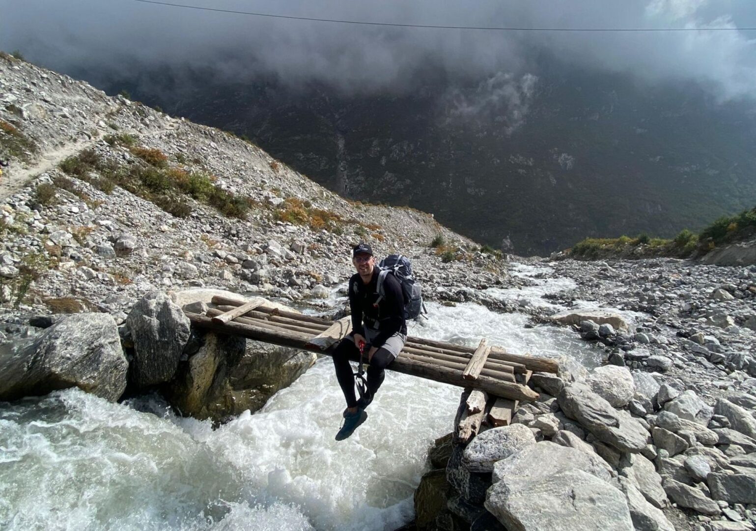
From Samdo, you follow a wide path, cross the Budhi Gandaki and walk alongside a long mani wall. The trail climbs towards the Larkya glacier. You reach Larkya Phedi with views over a deep gorge. An early night. Tomorrow is the big day.
Today is the day. You start before sunrise and move steadily through ice and stone, past frozen lakes, towards the pass. At the top, prayer flags snap in the wind. You made it. The descent to Bhimtang is long, but the sense of achievement carries you through.


💡 Interesting fact: the Larkya La Pass is one of the highest trekking passes in Nepal
At 5,106 m / 16,752 ft, the Larkya La is a serious crossing. The trail over the pass involves glacier terrain, frozen lakes and a long exposed ridge. Most groups start the crossing before 5am to avoid afternoon weather. The descent to Bhimtang drops more than 1,300 metres in a single day.
You cross a glacial stream and descend into a forest of rhododendrons and tall pines. With Manaslu still in view, you continue along the Dudh Khola through farmland to Tilje.


A fast descent towards the Marsyangdi valley. Through the forest, across a suspension bridge and onto the trail of the Annapurna Circuit. You spend the night in Chamje.
The final walking day. Tired, satisfied and with a pack full of memories, you reach the end point of the trek.
After breakfast, we board the bus back to Kathmandu.
Prefer the jeep?
That's possible. It's faster, a bit more flexible and includes some great stops along the way. Get in touch for details.
Walking & pace
We start the day early. Breakfast is at 7 AM, and we leave the lodge around 8. The morning hours are when the air is freshest and the views are at their clearest.
We stop for lunch towards the end of the morning. Lunch is freshly prepared, warm and unhurried. It can take a while for the food to come out, but that is part of the rhythm. You sit down, drink something, rest your legs and refuel for the afternoon.
In the afternoon, we usually walk a little further to reach the lodge for the night. By around five, we sit down for an early dinner. We order breakfast for the next morning at the same time, so it is ready when we are.
Throughout the day there is plenty of time to drink water, reapply sunscreen, take photos and simply look around. The mountains are not in a hurry, and neither are we.
Route
Altitude
About this trip
This trek takes you through a remote and restricted mountain region, circling the world’s 8th highest mountain over 13 walking days. You walk an average of 6 hours per day. The itinerary includes two acclimatisation days; one in Samagaon and one in Samdo, to give your body time to adjust before the Larkya La Pass.
The paths vary from wide river valley trails to narrow gorge paths, forest tracks and high alpine terrain above the tree line. The final day over the pass involves glacier terrain and a long descent. Trekking poles and warm layers are essential.
Quick facts
- Route type: loop
- Total distance: approximately 177 km / 110 mi
- Starting point: Seti Khola (790 m / 2,592 ft)
- Highest point: Larkya La Pass (5,106 m / 16,752 ft)
- End point: Besi Sahar (760 m / 2,494 ft)
- Number of trekking days: 13
- Highlights along the way:
- Tatopani hot springs
- Lho Gaon and the first views of Manaslu
- Samagaon and Birendra Tal glacial lake
- Samdo yak village
- Larkya La Pass
- Bhimtang
Practical
Everything you need to know before you go. Below you’ll find answers to the most frequently asked questions about this trip. Can’t find what you’re looking for? Feel free to reach out.
Altitude sickness can affect anyone. Regardless of age, fitness or experience. Even the most seasoned mountain walkers can struggle with it.
The best prevention is going up slowly. That’s why our itinerary deliberately includes acclimatisation days where needed. This gives your body time to adjust to the altitude.
Drink plenty of water and listen to your body. Headaches, dizziness or nausea are signals to take seriously. Our guides are trained to recognise symptoms and will adjust the programme if necessary.
And if you do get altitude sickness? Descending is the only right choice. No debate, no hesitation. That’s not failure. That’s wisdom.
During the trek you sleep in teahouses: simple mountain lodges with firm mattresses, pillows and blankets against the cold, and dal bhat in the shared dining room.
Expect a twin room, a shared bathroom and cold water. A hot shower or wifi is sometimes possible, usually for a small extra fee. Charging your electronics is always possible, sometimes for a small fee. And then there is the warm fire in the dining room, friendly hospitality and views no hotel can match. This is the Himalaya.
PS: even though pillows and blankets are provided, we recommend bringing your own warm sleeping bag. The nights at altitude get cold, and your own bag makes a real difference. After booking, you’ll receive a detailed packing list that helps you prepare for both the trek and the nights in the lodges.
The best preparation is simply walking. Preferably several days in a row, with a backpack and elevation gain. In the months before departure, build up to walking days of 5 to 6 hours. Work on your overall fitness with cardio training (running, cycling, swimming) and don’t neglect your legs: squats, lunges and stair training work wonders.
Just as important: break in your hiking boots in time. New boots in Nepal are a guaranteed recipe for blisters. Ideally, start your training 3 to 6 months before departure.
Once your trip is confirmed, you’ll receive all the practical information you need to leave well prepared. This includes visa information, recommended vaccinations and a detailed packing list.
After arriving in Kathmandu, there’s a pre-trip meeting with your guide. We go through the route, the latest weather forecasts and there’s plenty of room for any final questions. We also do a gear check, to make sure you have everything you need for the trip. Missing something, or not sure about your gear? We’ll head out together to sort it. Kathmandu has plenty of good outdoor shops. 😉
Yes. The Manaslu Conservation Area requires a restricted area permit, which can only be obtained through a registered trekking agency. This permit is included in the price of your trip. We take care of all the paperwork.
Nepal Trekking – Manaslu Circuit with Larkya La, the Remote Circuit
- A full loop around Manaslu, the world's eighth highest mountain
- Cross the Larkya La Pass at 5,106 m / 16,752 ft at your own pace
- Deep into restricted Tibetan territory, villages and landscapes few trekkers ever reach
Bird Watching: Annapurna Trek & Jungle Safari
Ask us a questionBird Watching: Annapurna Trek
Ask us a questionWhat our customers have to say
Don't just take our word for it. Discover what travelers before you wrote about traveling with us.
Excited to start trekking to Nepal?
Explore sample treks in Nepal, ready for your personal touch. Customize these journeys to suit your preferences. Explore sample treks in Nepal, ready for your personal touch. Customize these journeys to suit your preferences.

Founded by a Nepali and a Dutchie. The best of both worlds.
No mass tourism. Just honest, personal connection. Before, during and after your trip.
We pay fair wages, lighten porter loads and treat people and nature with respect.
In a nutshell
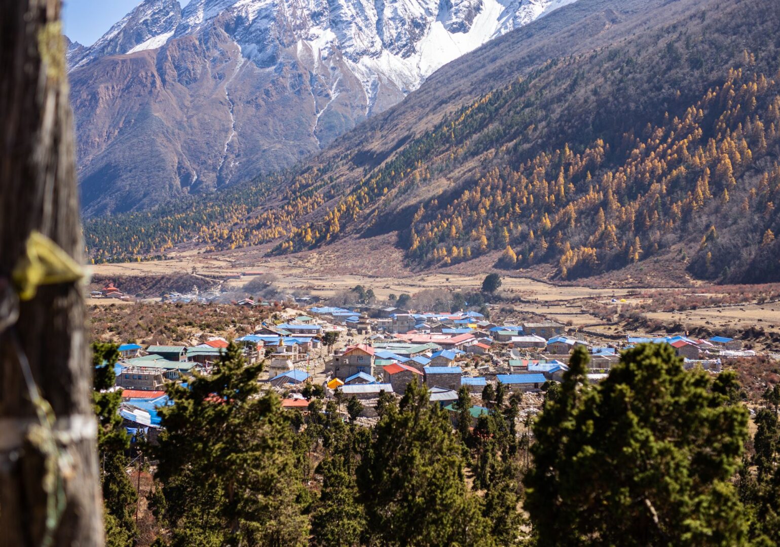
The Langtang Panorama Trek to Tserko Ri Peak takes you into the heart of the Langtang Valley in a short amount of time. This is one of the most beautiful trekking regions near Kathmandu. From the city, we drive to the start of the route. From there, we walk through dense forests of pine, bamboo and rhododendron, climbing gradually to the alpine meadows of Kyanjin Gompa, the last Tibetan village in the valley.
The highlight of this trip is the ascent of Tserko Ri (4,985 m / 16,355 ft). A solid climb, but one that pays off twice over. From the top, we have a 360-degree panorama of the surrounding Himalayan peaks. On clear days, you can even see the Tibetan plateau.
Although the Langtang Valley is relatively close to Kathmandu, it is less well known than the Everest and Annapurna regions. And that is exactly what makes it so special. It’s quieter, authentic and surprisingly diverse in landscape.
Note: This is a suggested itinerary. Your trip is custom-made to fit your wishes and experience. Tell us what you’re looking for. We’ll take care of the rest.


Spring (February through April) and autumn (mid-September through November) are the best seasons for this trek. The weather is stable, the skies are clear and the chance of snow on Tserko Ri is at its lowest.
Autumn is slightly busier. Spring is a little quieter, with rhododendron forests in full bloom along the route.
You don’t need to be a top athlete, but this trek does ask something of you. Think 4 to 7 hours of walking per day, several days in a row, at altitude. If you’re used to multi-day mountain hikes, you’ll generally be fine. The day to the summit of Tserko Ri (4,985 m) is the most demanding section: steep and possibly icy.
Not sure? Just get in touch. We’re happy to look at your experience level together and see whether this route suits you.
This is a suggested itinerary. A plan that shows what a trek like this can look like. Not how it has to go.
Want more time to acclimatise? Or prefer an extra day in Kyanjin Gompa? No problem. Want to combine the trip with a few extra days in Kathmandu before or after the trek, or perhaps a visit to another region in Nepal? That’s possible too.
Get in touch and we’ll create a trip that fits you.
What’s included
The price of this trip is per person, based on two people travelling together and sharing a twin or double room.
Are you travelling solo or with a larger group? We are happy to make you a custom price proposal. Just send us a message and we’ll get back to you with the options.
Included in this trip
- All required trekking permits
- Licensed, English speaking trekking guide (salary, transport, accommodation, meals, gear and insurance)
- Experienced mountain porter (salary, transport, accommodation, meals, gear and insurance)
- Private transport from Kathmandu to the trailhead and back
- All teahouse accommodation during your trek
- Breakfast, lunch and dinner during your trek
- 24/7 support from the By Mountain People team throughout your trip
- Booking secured through VZR Garant
- VAT and tourist service charge
Not included
- Water, hot or cold drinks, alcohol, etc.
- Travel health insurance covering rescue and evacuation — mandatory in Nepal
- All other expenses not listed under 'Included'
Day-to-day program
This is an example itinerary. It shows you how a trip like this is typically structured, day by day. Because we tailor every journey to your wishes and experience, the exact program may vary.
Note: walking times are indicative and depend on the pace of the group.
Early in the morning we board the bus to Syabrubesi, the starting point of the trek. After arriving and having lunch, we take our first steps towards Bamboo. Along the way, the landscape gradually opens up and the Himalaya reveals itself. We spend our first night in the mountains in Bamboo, a simple Tamang village surrounded by nothing but nature.

Prefer a jeep?
That's possible. It's faster, a bit more flexible and includes some great stops along the way. Get in touch for details.
After an early breakfast beside the rushing river, we set off on a long but rewarding day. The trail follows the Langtang Khola upstream through lush forest. We walk mostly in the shade, which makes the climbing much more pleasant. Along the way, there’s a good chance of spotting monkeys, and various bird species, and possibly wild honey in autumn. We reach Ghoda Tabela early in the afternoon, with plenty of time to rest and explore the surroundings.


From 3,000 metres, the first views of the surrounding peaks start to open up. The trail is relatively peaceful, though fully in the sun. Sunscreen and sunglasses are not a luxury here. Along the way, we pass more and more Tibetan villages, with small restaurants and locals in traditional dress. The Langtang Valley reveals itself here for the first time.


Did you know …
In April 2015, a 7.8 magnitude earthquake triggered a massive avalanche from Langtang Lirung. It buried the entire village under millions of tons of rock and ice. More than 240 people lost their lives here, both locals and trekkers. When you walk through Langtang Village today, you're not walking through the original village. The community rebuilt on a new site, slightly higher up the valley and away from the couloir that channelled the destruction in 2015. A more sheltered spot. Not the old place. The mani wall near the trail carries the names of everyone who died here. Take a moment when you pass it.
Today is an easier day, and that will probably feel good after the previous stages. After breakfast, we walk to Kyanjin Gompa in around four hours, the last village in the valley. After lunch, we take a short walk to explore the village. Kyanjin Gompa is a remarkable place: an ancient monastery, surrounded by a glacier and high mountain peaks.


🧀 Did you know …
In 1955, Swiss dairy expert Werner Schulthess came all the way to Kyanjin Gompa to set up Nepal's first commercial cheese factory. At nearly 3,900 metres above sea level. The milk comes from female yaks, known locally as naks, grazing the high pastures around the village. The cheese is hard, nutty and rich. You can visit the factory, watch the process up close, and buy a block to take with you. The best snack for the walk back down.
Active rest: a few ideas for the afternoon
Today is a short day. That doesn’t mean lying still. Walking up to a higher point during the day, then back to the lodge for the night, helps your body adjust to the altitude. Below you’ll find a few options for the afternoon. Pick what suits you, or take it easy at the lodge.
Visit Kyanjin Monastery
The monastery is the spiritual heart of the valley. It is around 300 years old, and the thangka paintings on the walls were brought here from Tibet some 400 years ago. Villagers, not monks, take turns opening and maintaining it. Step inside in the early morning, when butter lamps are still burning. And walk around it clockwise, as the locals do.
Hike Kyanjin Ri
The classic half-day hike from the village. You climb to 4,773 m / 15,659 ft and look out over Langtang Lirung, Dorje Lakpa, and the entire valley below. The trail is steep and short. On a clear day, you can see all the way to Shishapangma across the Tibetan border.
Hike to the glacier
A flatter walk north of the village, along the moraine of the Langtang Lirung glacier. No big climb, just you and the ice. Every now and then, you can hear the glacier crack and shift beneath the surface. A reminder that this landscape is alive.
An early start today. We set off around 5:00 AM towards the summit, with breakfast packed in our bags. The climb is demanding: over 1,200 metres of elevation gain in around five hours. But at the top, a 360-degree panorama awaits over the Langtang peaks, Dorje Lakpa, Shishapangma and on clear days even the Tibetan plateau. After a well-earned rest on the summit, we descend back to Kyanjin Gompa.


After an early breakfast beside the rushing river, we set off on a long but rewarding day. The trail follows the Langtang Khola upstream through lush forest. We walk mostly in the shade, which makes the climbing much more pleasant. Along the way, there’s a good chance of spotting monkeys, and various bird species, and possibly wild honey in autumn. We reach Ghoda Tabela early in the afternoon, with plenty of time to rest and explore the surroundings.


This is the last day of walking. We descend further to Syabrubesi, with a well-earned lunch along the way. We’ve completed a beautiful multi-day trek through the Himalaya, with the cherry on top being the summit of Tserko Ri.
Return to Kathmandu
Prefer to take an evening jeep back to Kathmandu? That's possible. Get in touch for details.

After breakfast, we board the bus back to Kathmandu.
Walking & pace
We start the day early. Breakfast is at 7 AM, and we leave the lodge around 8. The morning hours are when the air is freshest and the views are at their clearest.
We stop for lunch towards the end of the morning. Lunch is freshly prepared, warm and unhurried. It can take a while for the food to come out, but that is part of the rhythm. You sit down, drink something, rest your legs and refuel for the afternoon.
In the afternoon, we usually walk a little further to reach the lodge for the night. By around five, we sit down for an early dinner. We order breakfast for the next morning at the same time, so it is ready when we are.
Throughout the day there is plenty of time to drink water, reapply sunscreen, take photos and simply look around. The mountains are not in a hurry, and neither are we.
Route
Altitude
About this trip
This trek takes you through the foothills of the Langtang range. You walk an average of 5 to 6 hours per day, without high passes along the way. We have built no formal rest days, but 2 lighter walking days
The paths are mostly well-maintained mountain paths. Expect stone steps, rocky sections and possible snow or ice on the higher sections.
Quick facts
- Route type: out-and-back
- Total distance: approximately 80 km / 50 mi
- Starting point: Syabrubesi (1,462 m / 4,797 ft)
- Highest point: Tserko Ri (4,985 m / 16,355 ft)
- End point: Syabrubesi (1,462 m / 4,797 ft)
- Number of trekking days: 7
- Highlights along the way:
- Langtang Village
- Kyanjin Gompa
- Tserko Ri
Practical
Everything you need to know before you go. Below you’ll find answers to the most frequently asked questions about this trip. Can’t find what you’re looking for? Feel free to reach out.
Altitude sickness can affect anyone. Regardless of age, fitness or experience. Even the most seasoned mountain walkers can struggle with it.
The best prevention is going up slowly. That’s why our itinerary deliberately includes acclimatisation days where needed. This gives your body time to adjust to the altitude.
Drink plenty of water and listen to your body. Headaches, dizziness or nausea are signals to take seriously. Our guides are trained to recognise symptoms and will adjust the programme if necessary.
And if you do get altitude sickness? Descending is the only right choice. No debate, no hesitation. That’s not failure. That’s wisdom.
During the trek you sleep in teahouses: simple mountain lodges with firm mattresses, pillows and blankets against the cold, and dal bhat in the shared dining room.
Expect a twin room, a shared bathroom and cold water. A hot shower or wifi is sometimes possible, usually for a small extra fee. Charging your electronics is always possible, sometimes for a small fee. And then there is the warm fire in the dining room, friendly hospitality and views no hotel can match. This is the Himalaya.
PS: even though pillows and blankets are provided, we recommend bringing your own warm sleeping bag. The nights at altitude get cold, and your own bag makes a real difference. After booking, you’ll receive a detailed packing list that helps you prepare for both the trek and the nights in the lodges.
The best preparation is simply walking. Preferably several days in a row, with a backpack and elevation gain. In the months before departure, build up to walking days of 5 to 6 hours. Work on your overall fitness with cardio training (running, cycling, swimming) and don’t neglect your legs: squats, lunges and stair training work wonders.
Just as important: break in your hiking boots in time. New boots in Nepal are a guaranteed recipe for blisters. Ideally, start your training 3 to 6 months before departure.
Once your trip is confirmed, you’ll receive all the practical information you need to leave well prepared. This includes visa information, recommended vaccinations and a detailed packing list.
After arriving in Kathmandu, there’s a pre-trip meeting with your guide. We go through the route, the latest weather forecasts and there’s plenty of room for any final questions. We also do a gear check, to make sure you have everything you need for the trip. Missing something, or not sure about your gear? We’ll head out together to sort it. Kathmandu has plenty of good outdoor shops. 😉
Nepal Trekking – Tserko Ri Peak, the Langtang Panorama Trek
- From Kathmandu quickly into the mountains
- A 360-degree panorama from the summit of Tserko Ri
- Tibetan Buddhist villages, gompas and prayer flags
Bird Watching: Annapurna Trek & Jungle Safari
Ask us a questionBird Watching: Annapurna Trek
Ask us a questionWhat our customers have to say
Don't just take our word for it. Discover what travelers before you wrote about traveling with us.
Excited to start trekking to Nepal?
Explore sample treks in Nepal, ready for your personal touch. Customize these journeys to suit your preferences. Explore sample treks in Nepal, ready for your personal touch. Customize these journeys to suit your preferences.

Founded by a Nepali and a Dutchie. The best of both worlds.
No mass tourism. Just honest, personal connection. Before, during and after your trip.
We pay fair wages, lighten porter loads and treat people and nature with respect.
In a nutshell
The Everest Base Camp Trek via Gokyo combines two classic routes in the region into one big loop. You trek via the remote Gokyo lakes and the high Cho La pass to Everest Base Camp. Over two weeks in the heart of the Himalaya.
From Namche Bazaar, you leave the busy trail behind and turn into a quiet valley. From here, you climb gradually towards Gokyo, on the shores of the ice-cold Gokyo lake. From the top of Gokyo Ri, you look out over no fewer than four eight-thousanders, including Mount Everest itself. Then you cross the high Cho La pass and a glacier, the bold highlight of your trip.
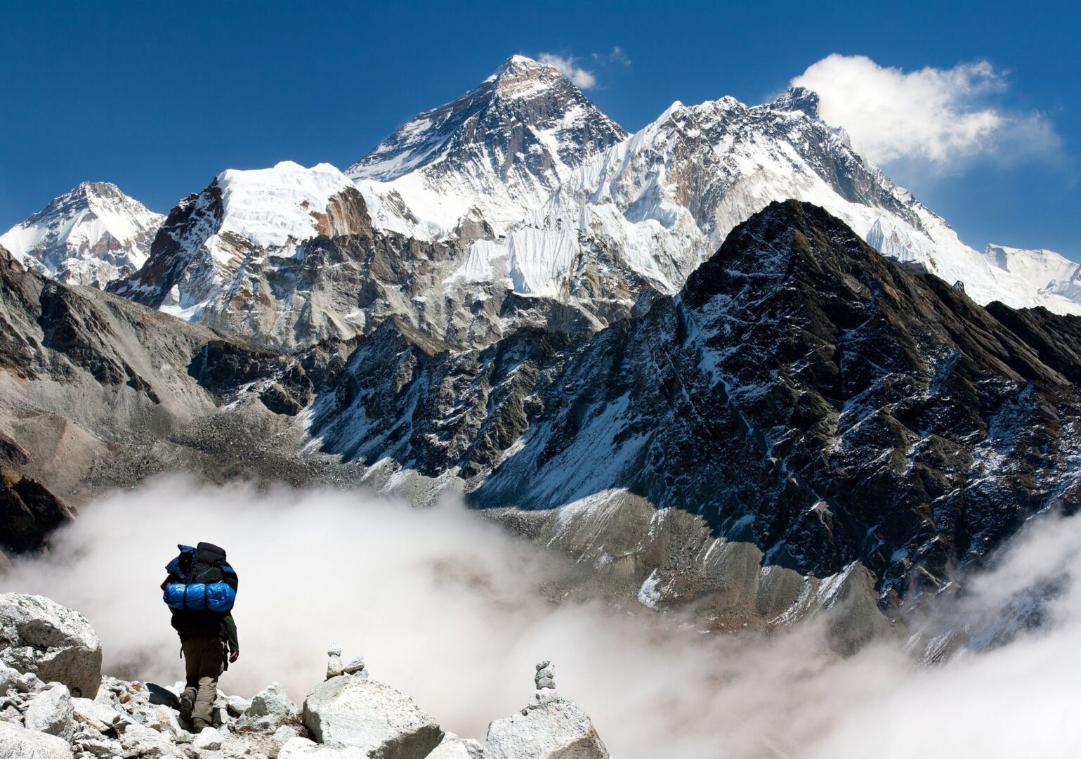
On the other side of the pass, you continue towards Everest Base Camp (EBC). The legendary place where expeditions set off for the highest summit in the world. You hike up to the top of Kala Patthar, where you feel almost face to face with the mighty Mount Everest.
This trek is not a quick up-and-back to Base Camp. The route is intentionally different from the standard base camp trek. Quieter, more varied and a bit more adventurous.
Note: This is a suggested itinerary. Your trip is custom-made to fit your wishes and experience. Tell us what you want. We’ll take care of the rest.
Spring (February through April) and autumn (mid-September through November) are the best seasons for this trek. The weather is stable, the skies are clear and the chance of snow on the Cho La pass is at its lowest. Autumn is slightly busier. Spring is a little quieter, with rhododendron forests in full bloom along the route.
You don’t need to be a top athlete, but this trek does ask something of you. Think 5 to 8 hours of walking per day, several days in a row, at altitude. If you’re used to multi-day mountain hikes, you’ll generally be fine. The Cho La pass (5,420 m) is the toughest section: steep, possibly icy and with a short glacier crossing.
Not sure? Just get in touch. We’re happy to look at your fitness level together and see whether this route suits you.
Once your trip is confirmed, you’ll receive all the practical information you need to leave well prepared. This includes visa information, recommended vaccinations and a detailed packing list.
After arriving in Kathmandu, there’s a pre-trip meeting with your guide. We go through the route, the latest weather forecasts and there’s plenty of room for any final questions. We also do a gear check, to make sure you have everything you need for the trip. Missing something, or not sure about your gear? We’ll head out together to sort it. Kathmandu has plenty of good outdoor shops. 😉
This is a suggested itinerary. A plan that shows what a trek like this can look like. Not how it has to go.
Want more time to acclimatise? Or prefer an extra day at the Gokyo lakes? No problem. Want to combine the trip with a few extra days in Kathmandu before or after the trek, or perhaps a visit to another region in Nepal? That’s possible too.
Get in touch and we’ll create a trip that fits you.
Yes! Check the available departure dates or get in touch if you have any questions.
Trek clockwise or anti-clockwise?
You can trek this route clockwise or anti-clockwise. Trekking clockwise helps your body acclimatise more gradually and safely. Plus: clockwise is considered respectful in Nepal. Just like when you pass a mani-wall or a stupa.
What’s included
The price of this trip is per person, based on two people travelling together and sharing a twin or double room.
Are you travelling solo or with a larger group? We are happy to make you a custom price proposal. Just send us a message and we’ll get back to you with the options.
Included in this trip
- All required trekking permits
- Licensed, English speaking trekking guide (salary, transport, accommodation, meals, gear and insurance)
- Experienced mountain porter (salary, transport, accommodation, meals, gear and insurance)
- Airport transfer from Thamel to the domestic airport
- Domestic flight from Kathmandu to Lukla (the trailhead) and back
- All teahouse accommodation during your trek
- Breakfast, lunch and dinner during your trek
- 24/7 support from the By Mountain People team throughout your trip
- Booking secured through VZR Garant
- VAT and tourist service charge
Not included
- Water, hot or cold drinks, alcohol, etc.
- Travel health insurance covering rescue and evacuation — mandatory in Nepal
- All other expenses not listed under 'Included'
Day-to-day program
This is an example itinerary. It shows you how a trip like this is typically structured, day by day. Because we tailor every journey to your wishes and experience, the exact program may vary.
Note: walking times are indicative and depend on the pace of the group.
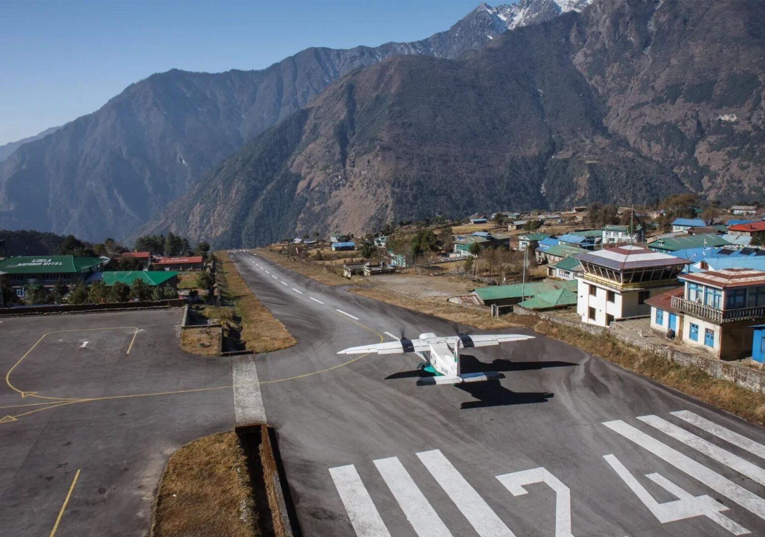
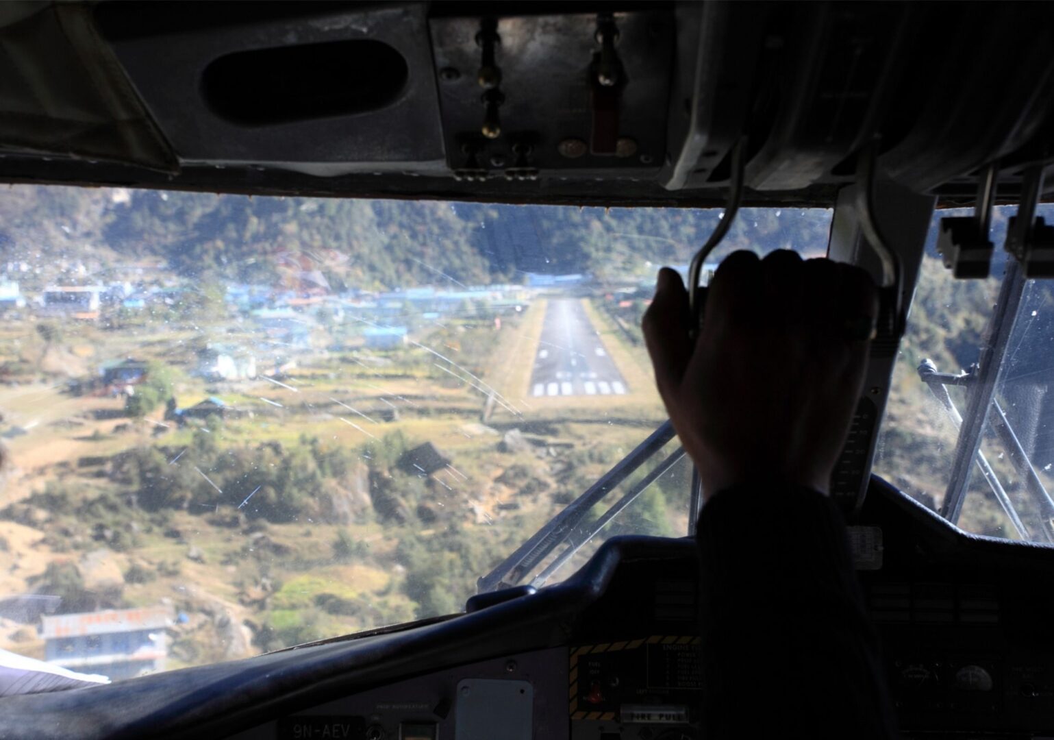
Today the adventure begins. Depending on the season, we fly from Kathmandu or Ramechhap to Lukla. Flying from Ramechhap? Then the day starts early. Very early. Between 1:00 and 3:00 in the morning, we get on the bus. From Kathmandu it’s a little more relaxed, with an early morning start.
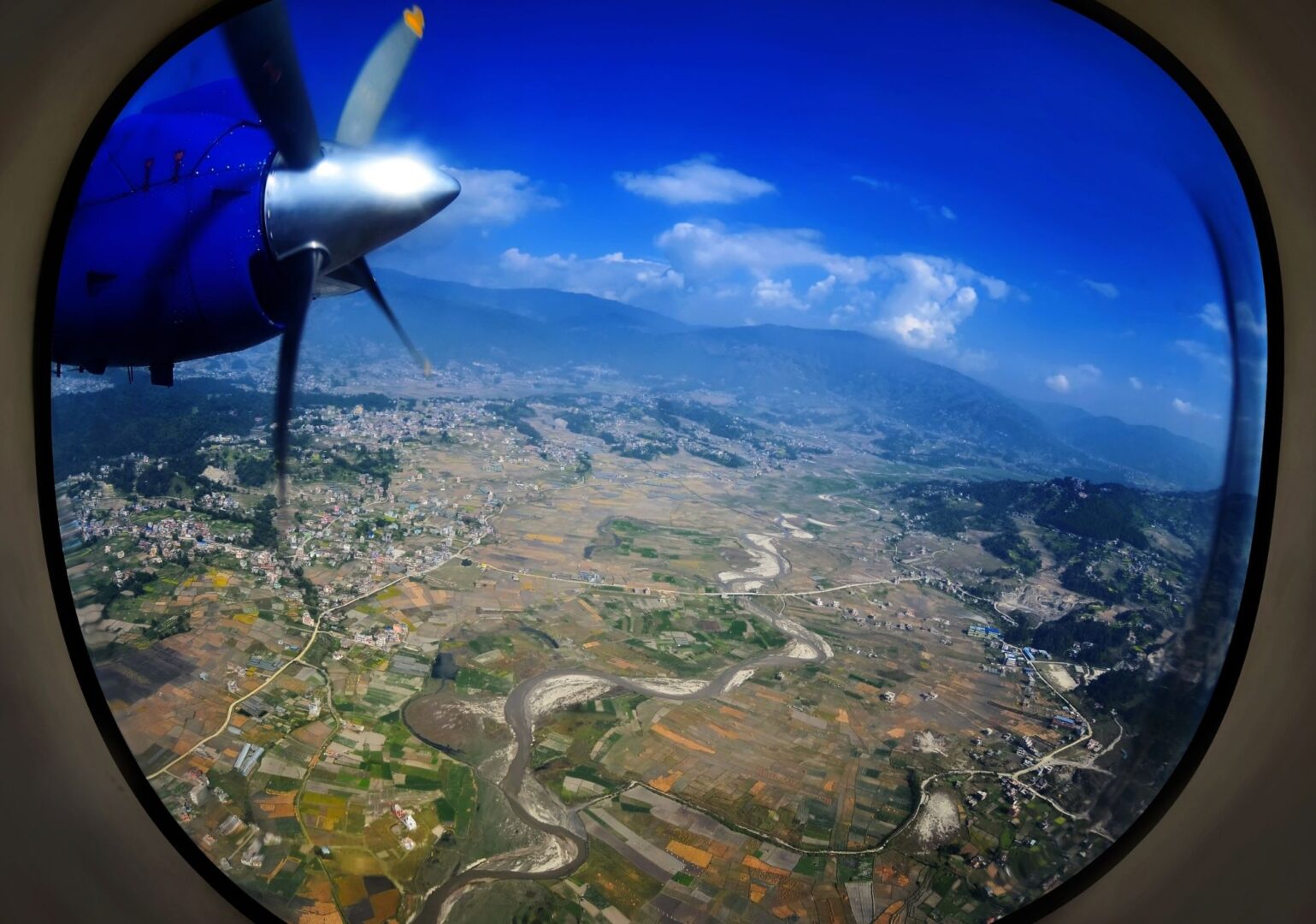
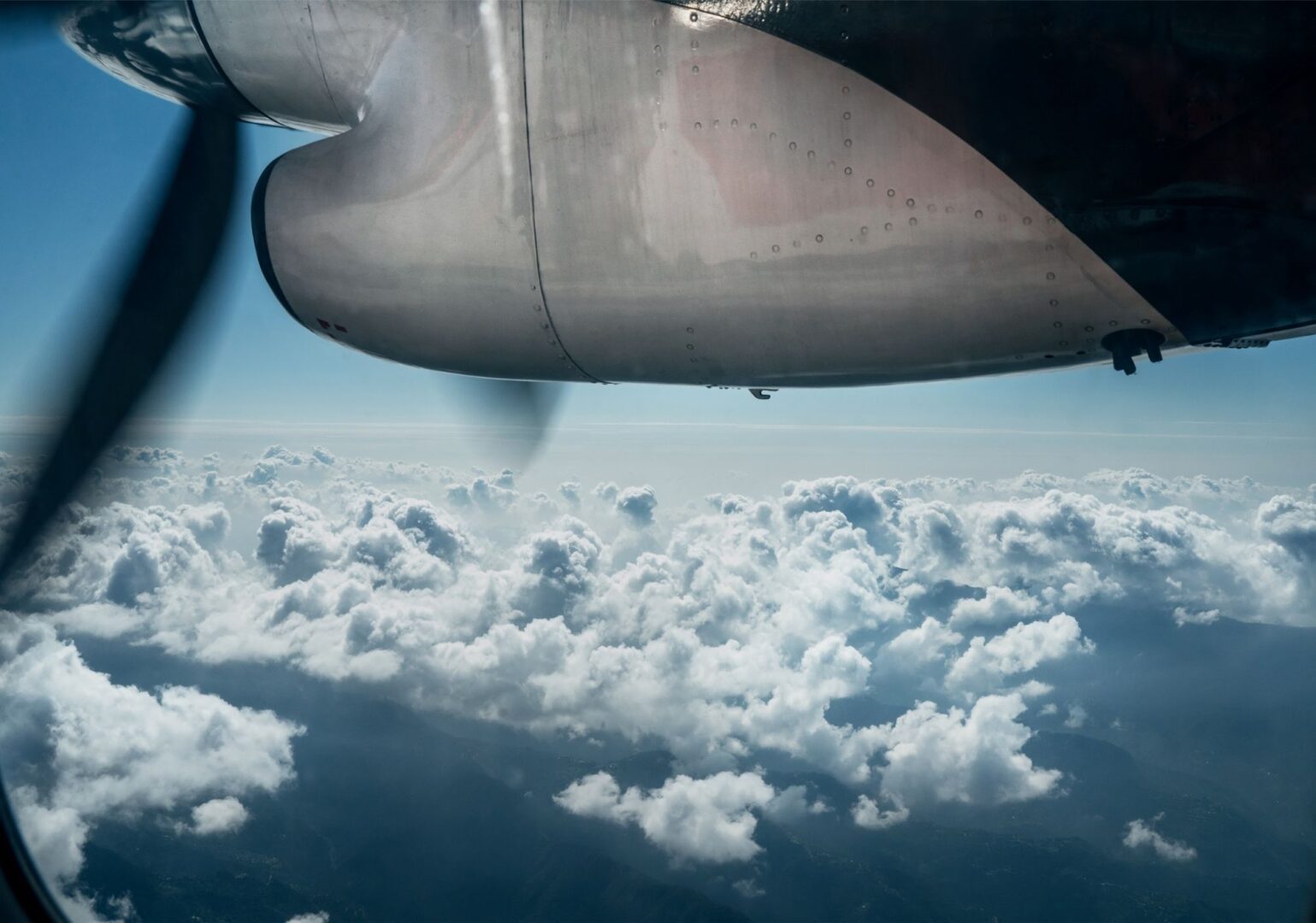
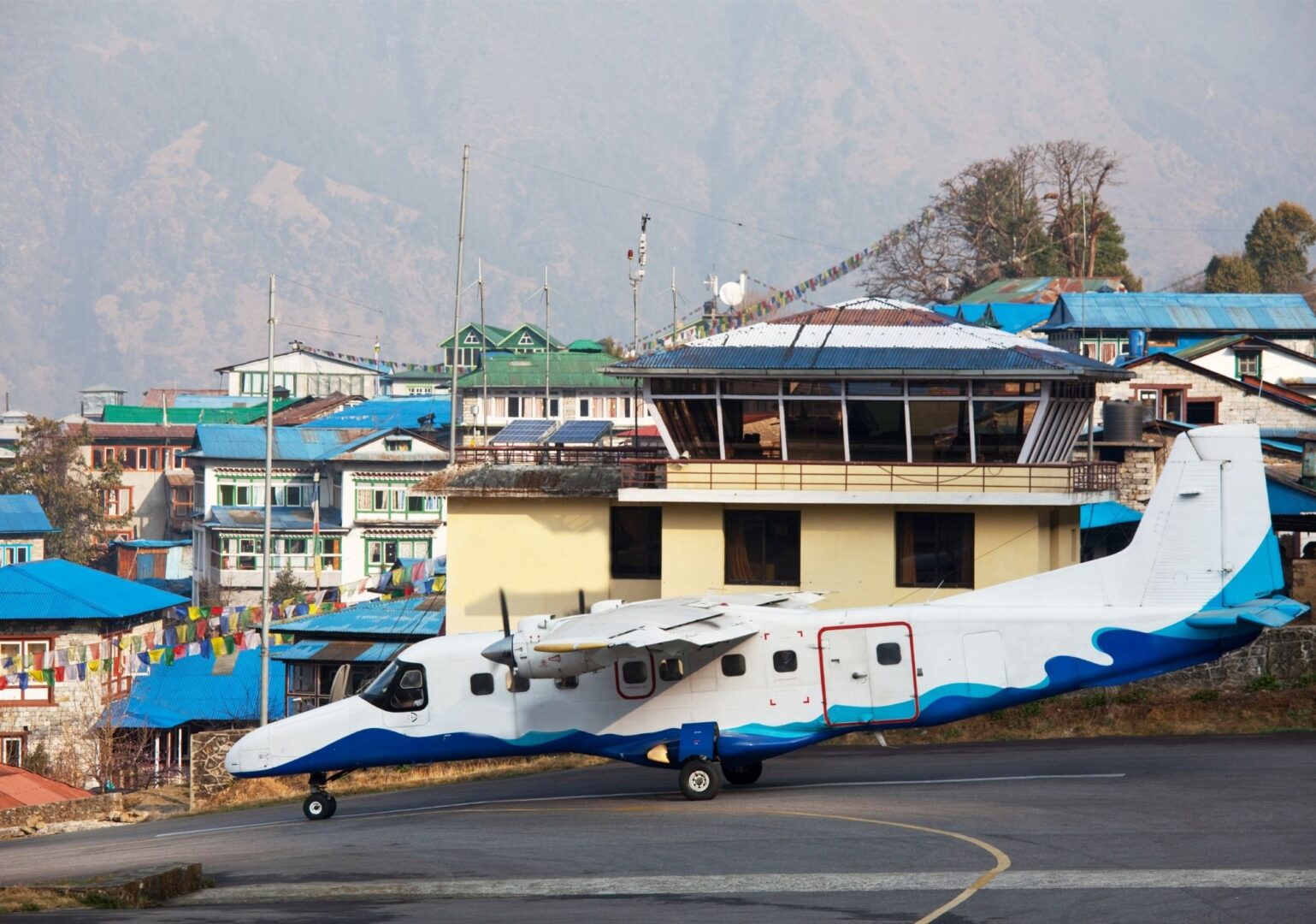
The flight to Lukla is an experience in itself. A small plane, spectacular mountain peaks and a runway you won’t forget in a hurry. After landing, the walk really begins, heading towards Phakding. It’s a relaxed, pleasant walk along the Dudh Koshi river.
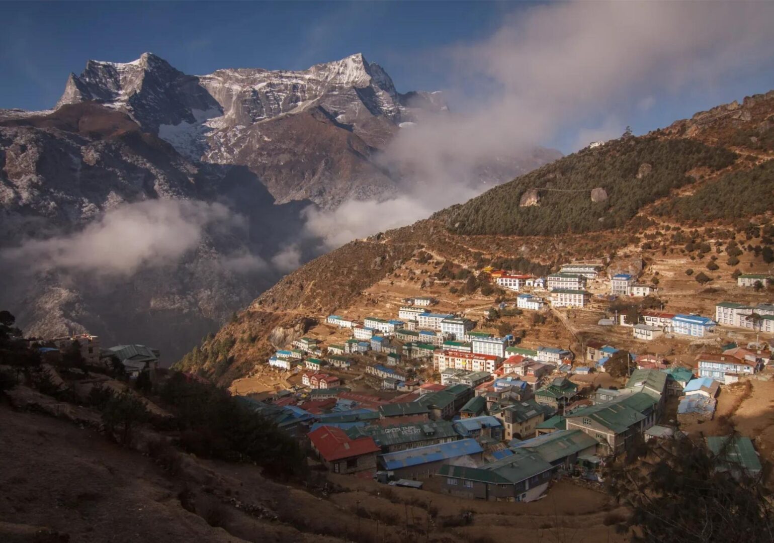
Today we walk to Namche Bazaar, the beating heart of the Everest region. Along the way, we cross the Dudh Khosi river several times via impressive suspension bridges decorated with colourful prayer flags. After passing through the entrance to Sagarmatha National Park, the trail climbs steeply upward. The views along the way more than make up for it.
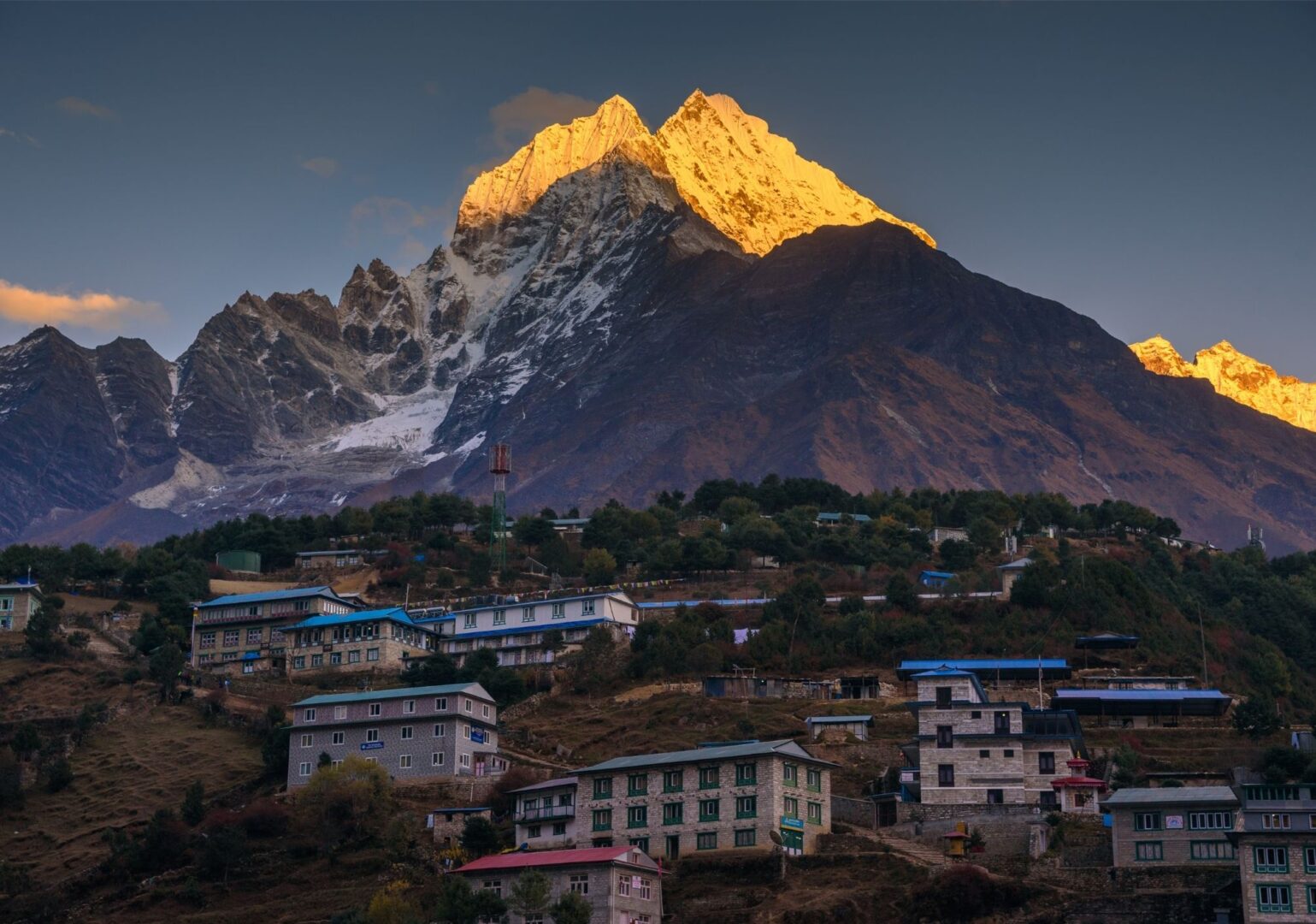
Namche itself is a lively mountain village that surprises many first-time visitors. It has everything: good restaurants, shops and even bakeries. Take some time to explore it at your own pace.
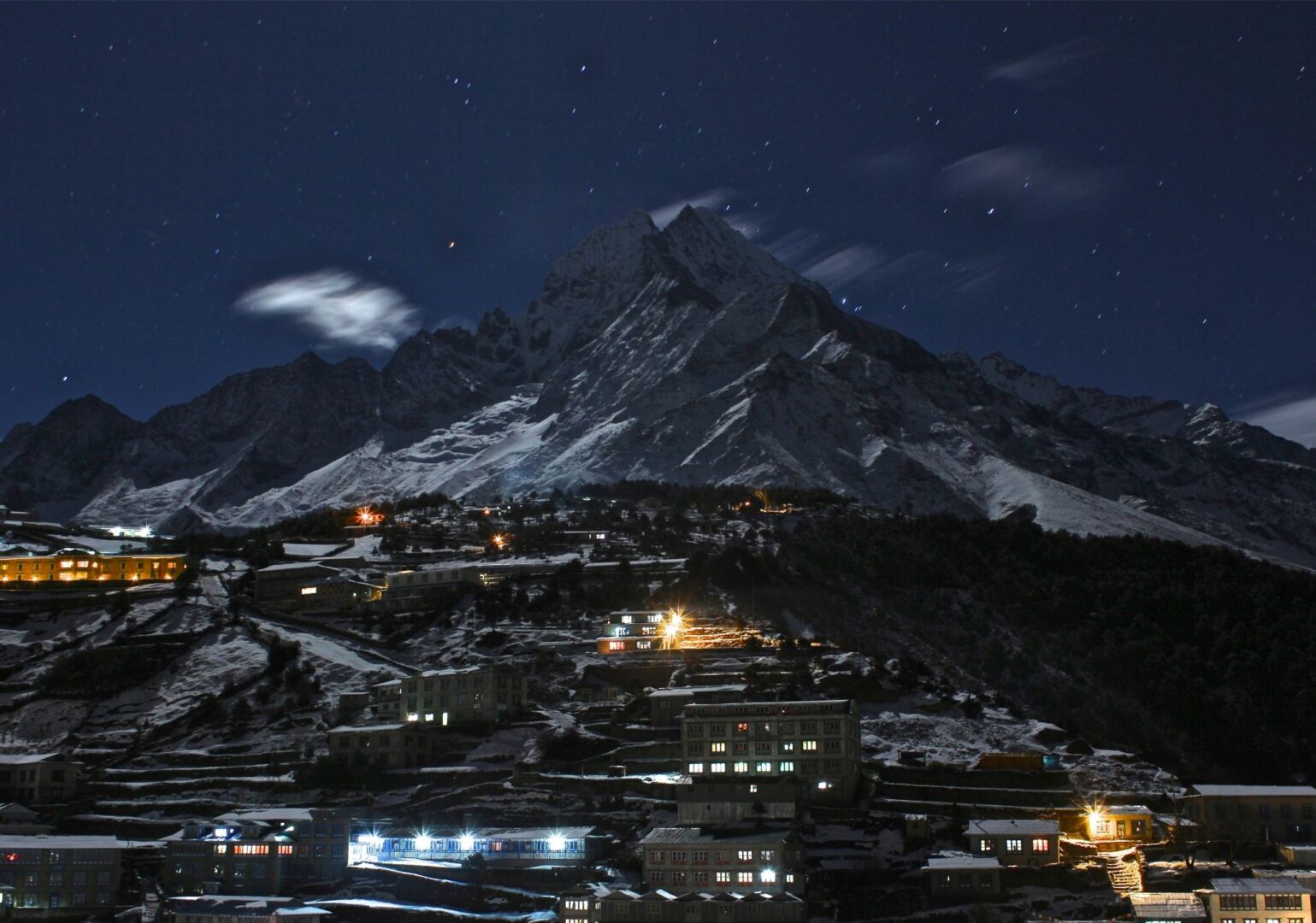
A rest day, but certainly not a dull one. Your body needs time to adjust to the altitude, and today we take that time. A short hike to the Sherpa Museum or the viewpoint at Syangboche is a great way to spend the day. The views across the Khumbu peaks are simply spectacular. Especially at sunrise and sunset.
Fun fact about Namche?
Fun fact here. Fun fact here.
Active rest: a few ideas for today
Today is built for acclimatisation. That doesn’t mean lying still. Walking up to a higher point during the day, then back to the lodge for the night, helps your body adjust to the altitude. Below you’ll find a few options for the day. Pick what suits you, or take it easy at the lodge.
Hike to Everest Hotel
Add info here
Hike to Sherpa Museum
Add info here
Another hike or tip?
Add info here
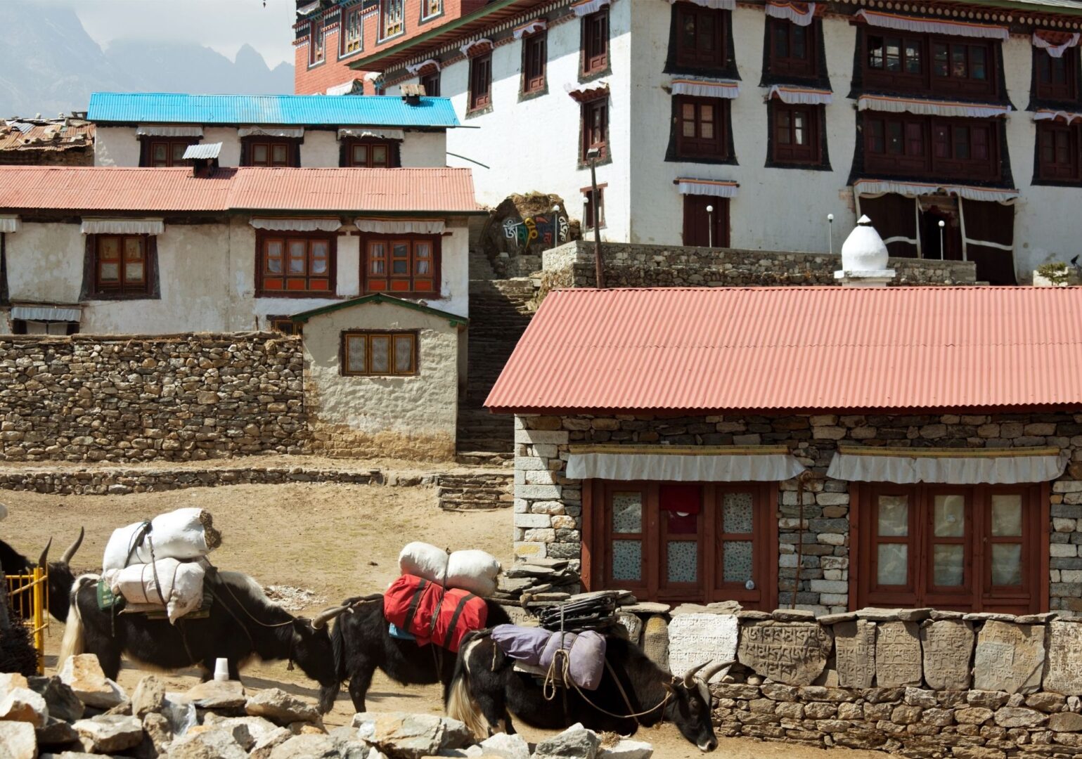
Today we leave the busy trail towards Base Camp and take a quieter path. We climb up via Khumjung Hill and then descend through a wide valley towards the Dudh Khosi river. Along the way we pass a chorten on a mountain ridge and the village of Mohang, the birthplace of a reincarnated lama said to have introduced Buddhism to the Khumbu region. A place with a lot of history.
Today we walk through a beautiful rhododendron forest. In spring, it’s an explosion of deep pink and green. The trail runs past a waterfall and through a small village before we reach Dole. The altitude is now really starting to make itself felt, and the landscape becomes wilder and quieter.
A steady climb today, along the Dudh Khosi river. We pass a chorten and walk through small villages. The surroundings grow quieter and more rugged as you gain altitude. Machhermo itself is a small, remote settlement.
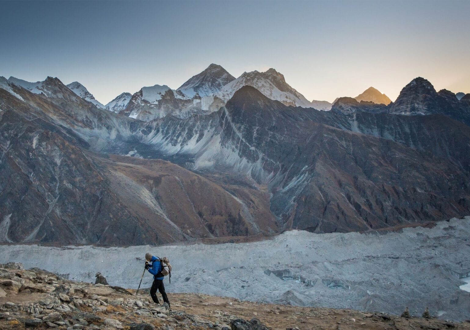
This is a day that will stay with you. We leave the inhabited world behind and step into the rugged high mountains. The trail passes chortens on a mountain ridge, with views of Kantega (6,782 m) and the mighty Cho Oyu (8,188 m), the sixth-highest mountain in the world.
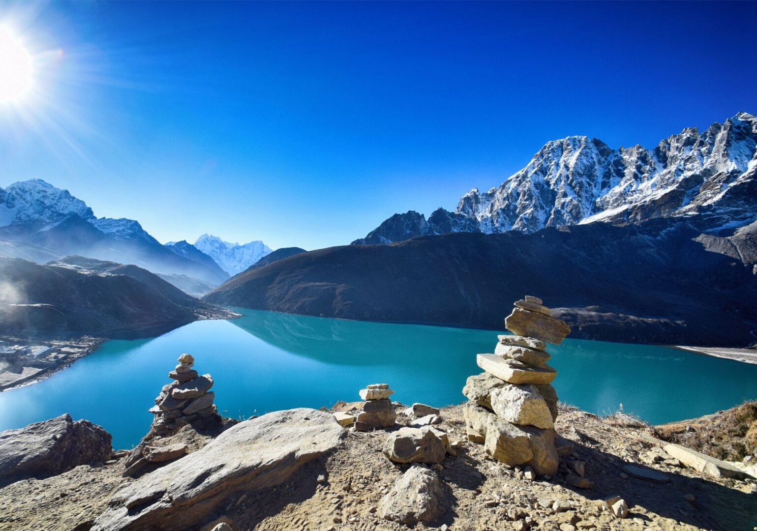
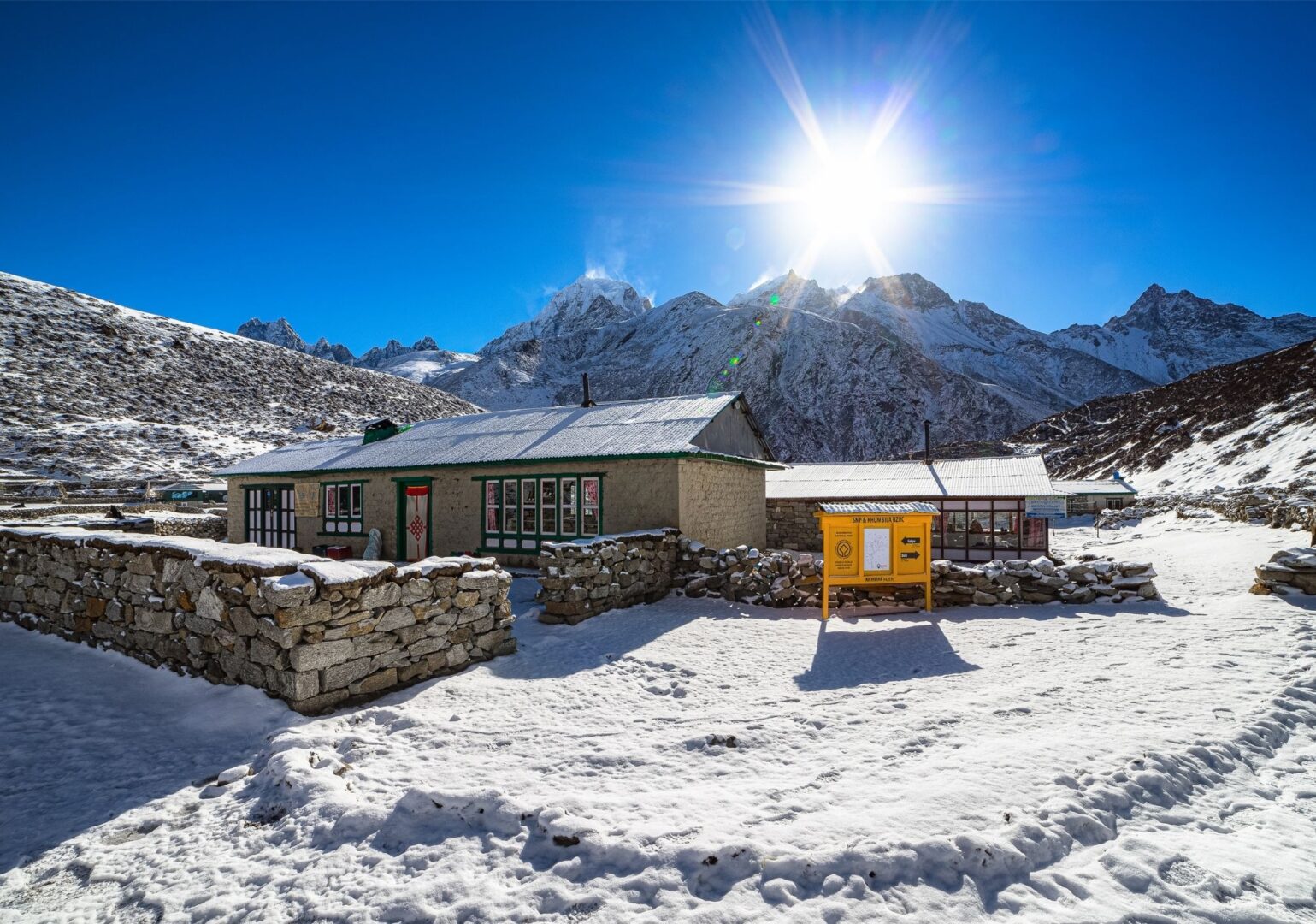
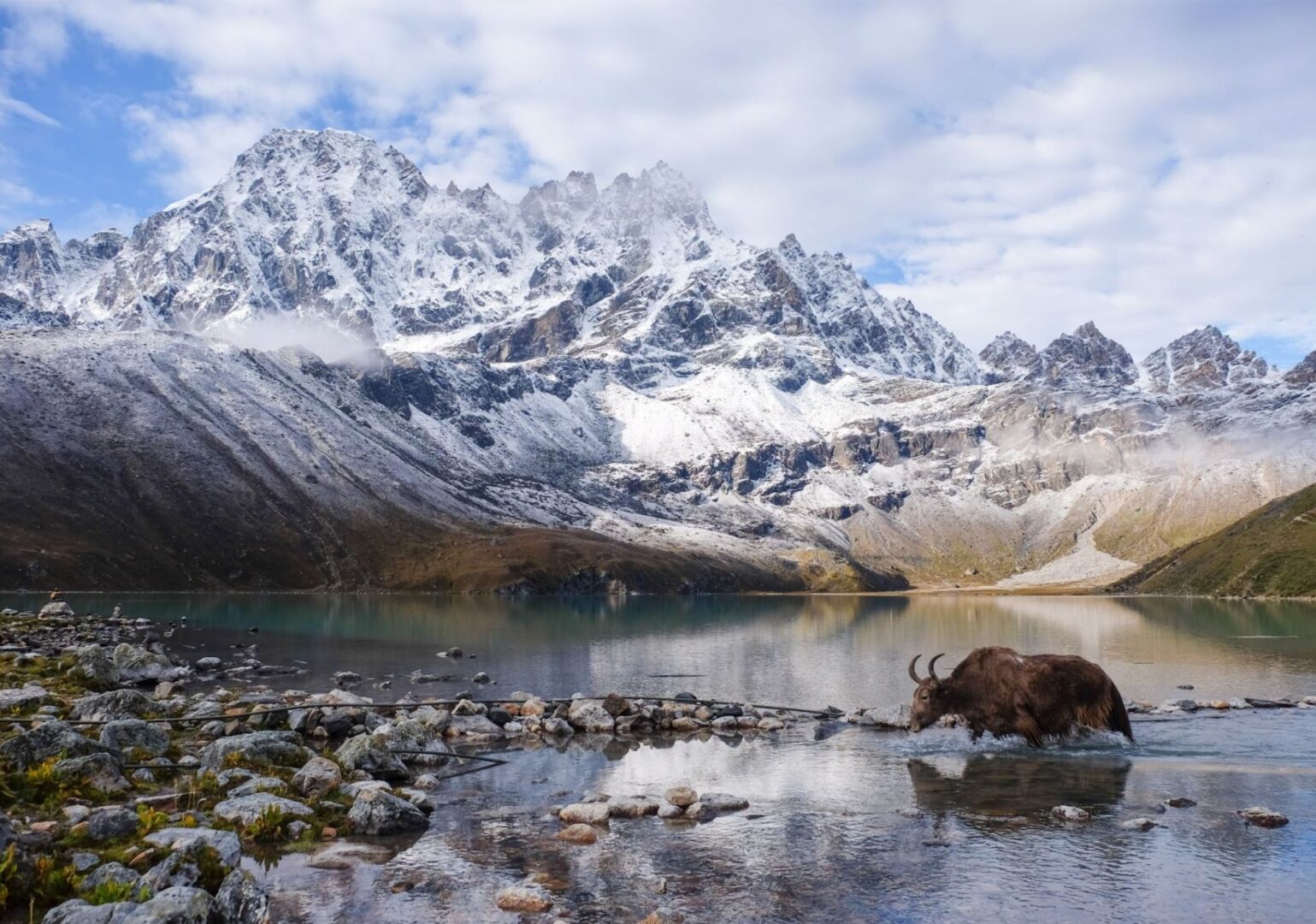
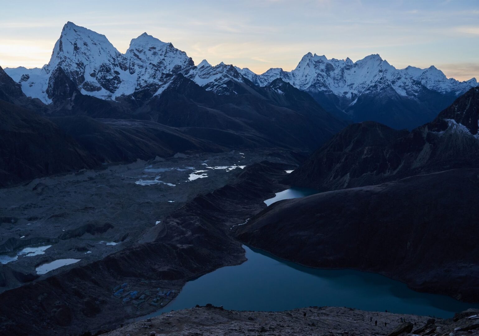
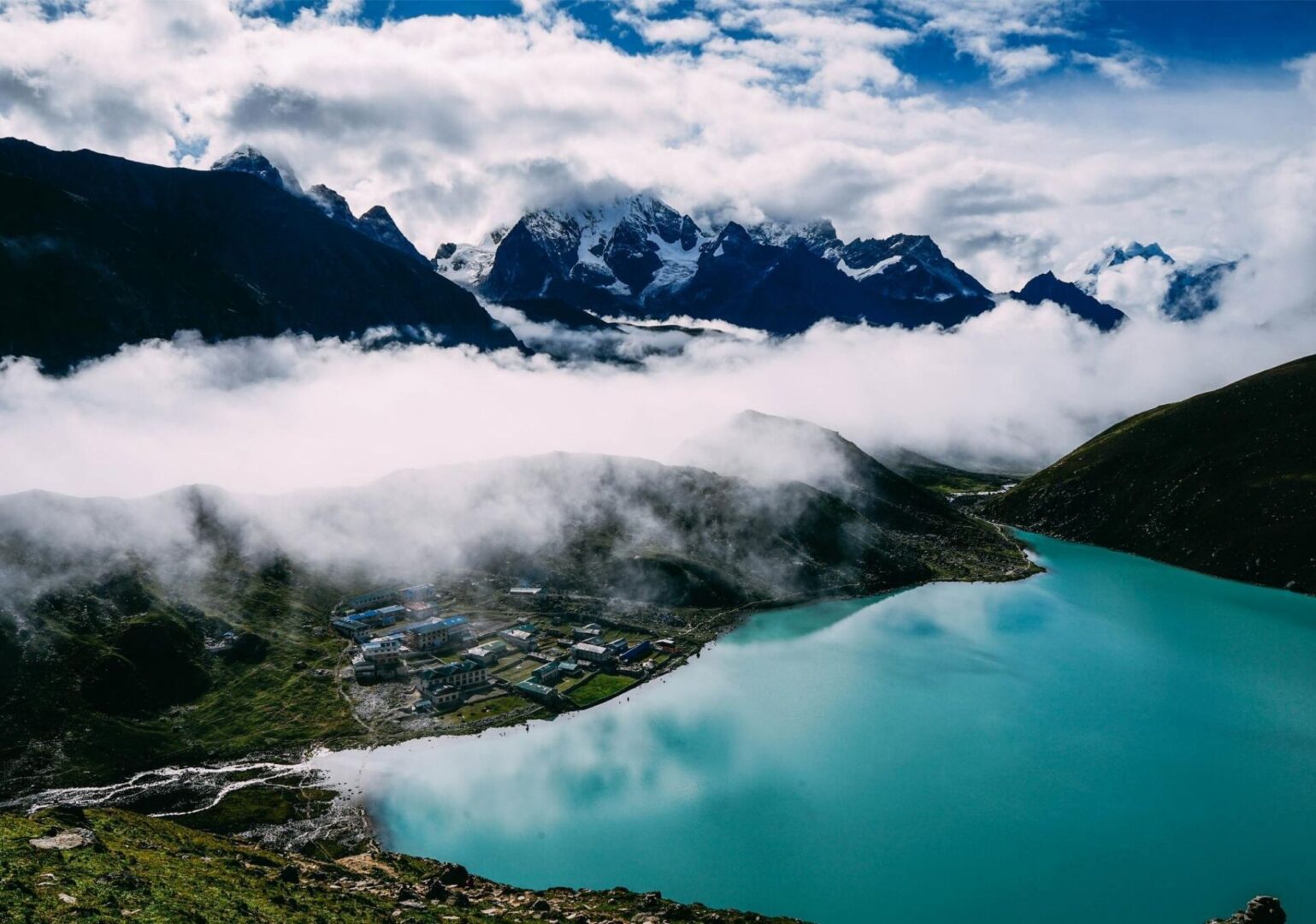
Then we reach the Ngozumpa Glacier — the longest glacier in the Himalaya. We walk along its edge and pass the first and second sacred lakes before arriving in Gokyo, on the shore of the third lake, Dudh Pokhari. The mirror-smooth surface reflects the mountain peaks all around. It’s almost unreal, it’s so beautiful.
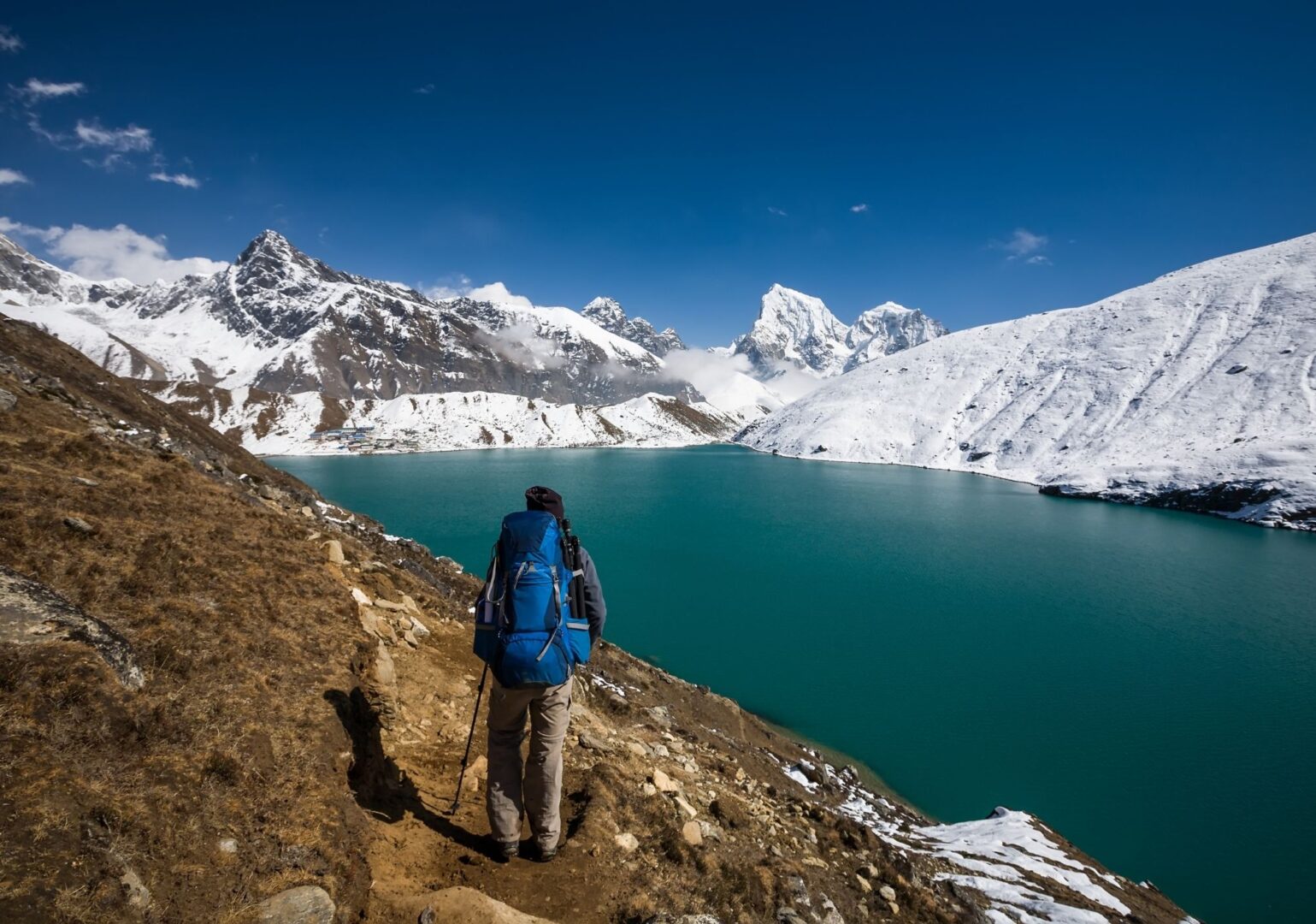
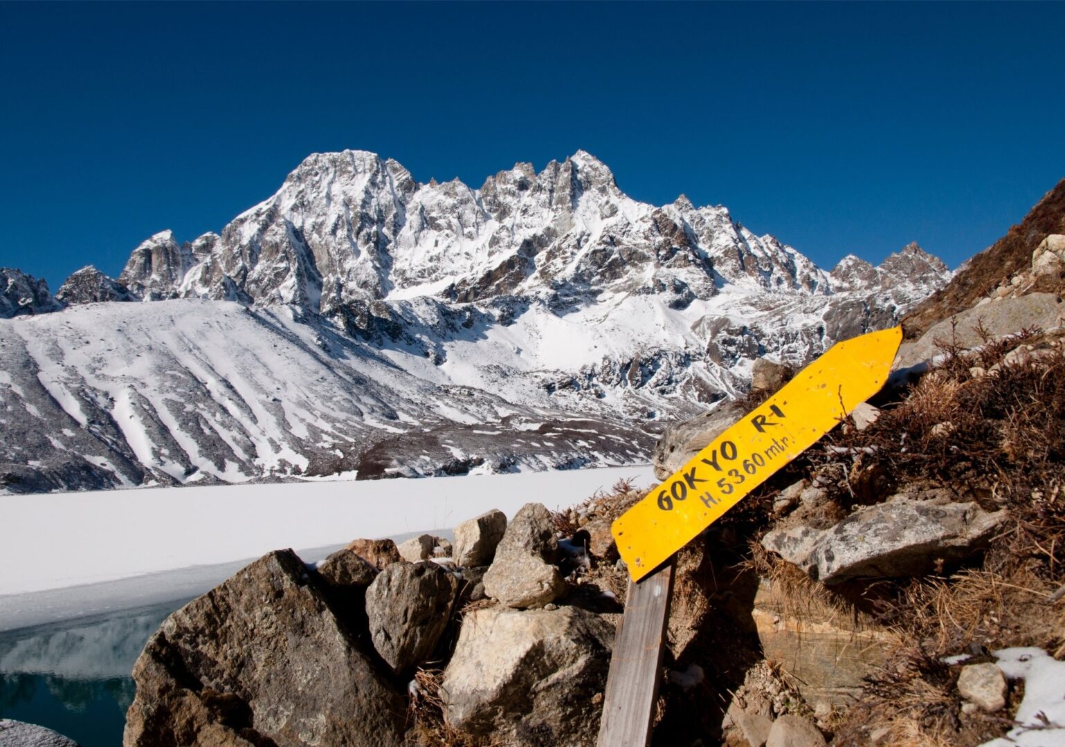
An early start today. Before the sun rises, we step outside and begin the ascent of Gokyo Ri. It’s about two hours of climbing at a steady pace, until we reach the summit, marked by an enormous tangle of prayer flags.
In clear weather, the view from the top is beyond words. Cho Oyu, Everest, Lhotse, Makalu, four of the highest mountains in the world, right in front of you. And below you, the Ngozumpa Glacier cuts through the landscape like a giant scar. These are views you normally only see in expedition photographs.
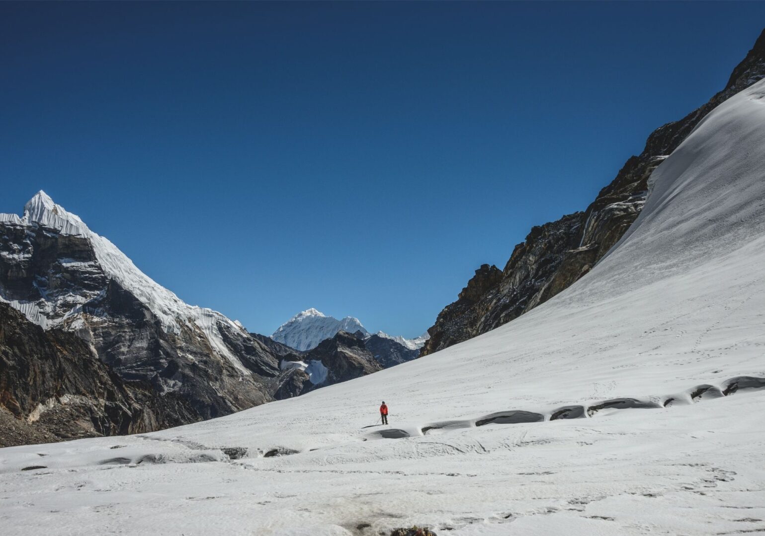
A short day today. And intentionally so. We cross the Ngozumpa Glacier and follow the mountain wall to the small settlement of Dragnag. The afternoon is yours to rest and recharge. Because tomorrow we cross the Cho La pass.
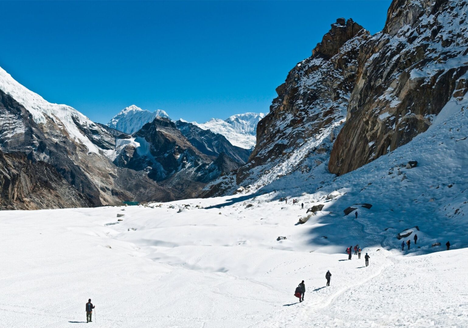
This is probably the toughest day of the entire trip, and also an unforgettable one. The Cho La pass is not technical or difficult, but it is steep and can be slippery and icy. It requires concentration.
At the top of the pass, colourful prayer flags flutter in the wind. In clear conditions, the views here are breathtaking. You can see the pyramid-shaped Ama Dablam, Cholatse, Lobuche East, a panorama you won’t forget. After crossing a few glacier crevasses, we descend to Dzonglha, from where you look out over an endless mountain landscape.
After the intense day yesterday, this is a welcome, more relaxed day. We descend from Dzonglha via a green trail with views of Lobuche Peak and follow the wide river valley to Lobuche. The rest of the day is yours, for a good book, or simply soaking up the views.
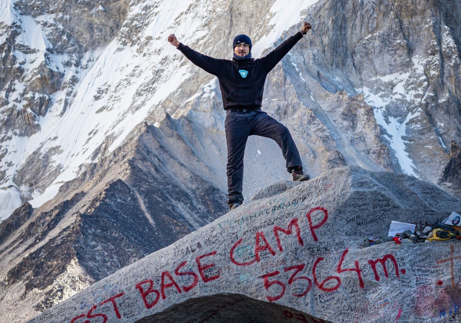
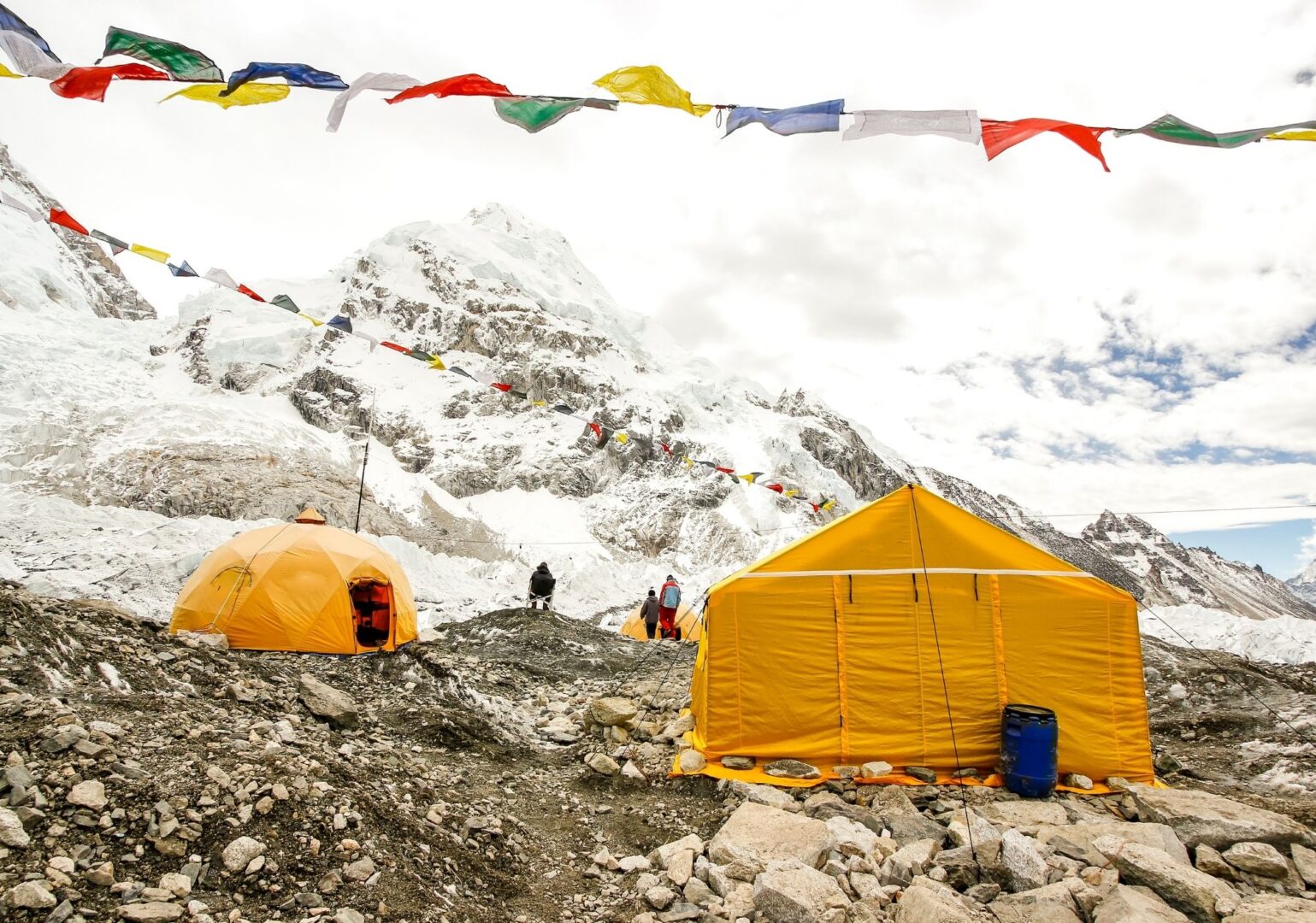
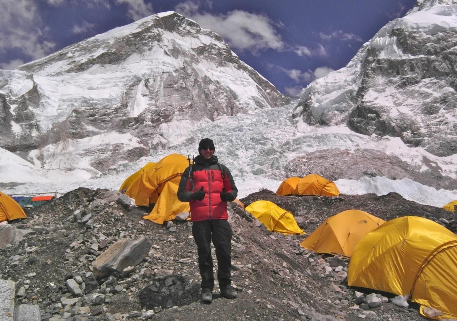
Today we reach another highlight of this adventurous trek: Everest Base Camp. The trail leads through the former Gorak Shep lake, past memorial monuments and over rocky moraine. The thin air makes itself felt. So we take our time.
At Base Camp, you see the colourful tents of expeditions against a backdrop of grey rock and ice. And the giant Nuptse, Khumbutse and Pumori towering above you. After exploring Base Camp, we make our way back to Gorak Shep.
Fun fact EBC
Add info here
Another early start. In the dark, in the cold. The temperature here can easily drop to -10 or even -15 degrees Celsius. But when you reach the top of Kala Patthar and Everest unfolds before you, the cold somehow seems to disappear for a bit. Mount Everest feels even closer than you might have imagined.
After this moment, we descend to Pheriche. For a warm meal and hopefully a good night’s sleep.
The descent begins. We pass Pangboche and the oldest monastery in the region, where the skull and bones of a yeti are said to be kept… Then we continue to the monastery at Tengboche, high on a mountain ridge with views of Ama Dablam, before returning to the familiar surroundings of Namche Bazaar.
Today is our last day in the mountains. We walk back to Lukla, the place where everything began.
You didn’t take the shortest route to Base Camp. You made an incredible journey via Gokyo, over the Cho La pass and through places very few people ever reach.
From the air, you get one last look at the peaks you’ve spent the past weeks getting to know up close. After landing in Kathmandu or Ramechhap, our team takes you to your hotel.
Walking & pace
We start the day early. Breakfast is at 7 AM, and we leave the lodge around 8. The morning hours are when the air is freshest and the views are at their clearest.
We stop for lunch towards the end of the morning. Lunch is freshly prepared, warm and unhurried. It can take a while for the food to come out, but that is part of the rhythm. You sit down, drink something, rest your legs and refuel for the afternoon.
In the afternoon, we usually walk a little further to reach the lodge for the night. By around five, we sit down for an early dinner. We order breakfast for the next morning at the same time, so it is ready when we are.
Throughout the day there is plenty of time to drink water, reapply sunscreen, take photos and simply look around. The mountains are not in a hurry, and neither are we.
Route
Altitude
About this trip
This trek takes you through the Khumbu region, home of Mount Everest. You walk an average of 5 to 7 hours per day, with one high pass along the way. We have built 2 rest days into the itinerary for acclimatisation, in Namche Bazaar and in Gokyo.
The paths are mostly a mix of forest paths, rocky sections and exposed mountain trails. Expect stone steps, a landslide area and possible snow or ice on the higher sections. Some sections are demanding, others are gentle.
We classify this trip as 3 boots on our difficulty scale.
Quick facts
- Route type: loop
- Total distance: approximately 140 km
- Starting point: Lukla (2,860 m / 9,380 ft)
- Highest point: Kala Patthar (5,644 m / 18,519 ft)
- End point: Lukla (2,860 m / 9,380 ft)
- Number of trekking days: 13
- Number of rest days: 2
- Highlights along the way:
- Namche Bazaar
- Gokyo Lake
- Gokyo Ri
- Cho La Pass
- EBC
- Kala Patthar
Practical
Everything you need to know before you go. Below you’ll find answers to the most frequently asked questions about this trip. Can’t find what you’re looking for? Feel free to reach out.
The best preparation is simply walking. Preferably several days in a row, with a backpack and elevation gain. In the months before departure, build up to walking days of 5 to 6 hours. Work on your overall fitness with cardio training (running, cycling, swimming) and don’t neglect your legs: squats, lunges and stair training work wonders.
Just as important: break in your hiking boots in time. New boots in Nepal are a guaranteed recipe for blisters. Ideally, start your training 3 to 6 months before departure.
Altitude sickness can affect anyone. Regardless of age, fitness or experience. Even the most seasoned mountain walkers can struggle with it.
The best prevention is going up slowly. That’s why our itinerary deliberately includes acclimatisation days where needed. This gives your body time to adjust to the altitude.
Drink plenty of water and listen to your body. Headaches, dizziness or nausea are signals to take seriously. Our guides are trained to recognise symptoms and will adjust the programme if necessary.
And if you do get altitude sickness? Descending is the only right choice. No debate, no hesitation. That’s not failure. That’s wisdom.
During the trek you sleep in teahouses: simple mountain lodges with firm mattresses, pillows and blankets against the cold, and dal bhat in the shared dining room.
Expect a twin room, a shared bathroom and cold water. A hot shower or wifi is sometimes possible, usually for a small extra fee. Charging your electronics is always possible, sometimes for a small fee. And then there is the warm fire in the dining room, friendly hospitality and views no hotel can match. This is the Himalaya.
PS: even though pillows and blankets are provided, we recommend bringing your own warm sleeping bag. The nights at altitude get cold, and your own bag makes a real difference. After booking, you’ll receive a detailed packing list that helps you prepare for both the trek and the nights in the lodges.
Nepal Trekking – Everest Base Camp with Gokyo Lake, the Adventure Trail
- Across the high Cho La pass, on a great loop through the Khumbu region
- Two summits, two panoramas: Gokyo Ri and Kala Patthar
- The quiet route to Everest Base Camp
Bird Watching: Annapurna Trek & Jungle Safari
Ask us a questionBird Watching: Annapurna Trek
Ask us a questionWhat our customers have to say
Don't just take our word for it. Discover what travelers before you wrote about traveling with us.
Excited to start trekking to Nepal?
Explore sample treks in Nepal, ready for your personal touch. Customize these journeys to suit your preferences. Explore sample treks in Nepal, ready for your personal touch. Customize these journeys to suit your preferences.